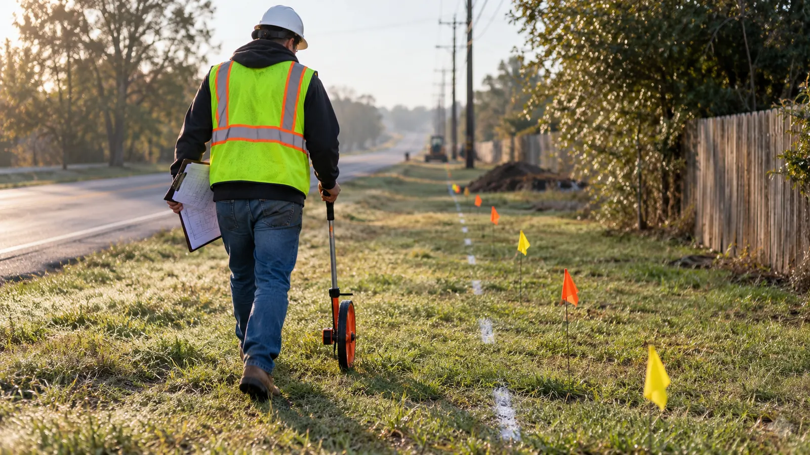
What is a construction site survey for utility work?
A construction site survey records existing conditions before a proposed build. For anyone asking what is a construction site survey before utility work, 2 distinctions matter: what the field team can observe and what requires separate verification. For fiber routes, engineering fielding supplies measured information that supports design and permit decisions.
A line on a route map can pass through a locked gate without showing the problem. We want the field record to expose that obstacle while the alignment can still change, just as it should flag a situation where a pole shown in the base map has been replaced, or a proposed underground entrance meets a drainage structure that the available records omit. Each finding changes a specific design decision.
Draftech's field survey is engineering fielding, not a boundary or topographic survey. We document utility infrastructure and route conditions for engineering. A land boundary survey by a licensed surveyor establishes or retraces property boundaries within its professional scope. A topographic survey supplies terrain and elevation information under its defined scope. When a project needs either service, specify it separately and arrange the appropriate qualified professional.
Choose the survey by the decision it must support
The word survey covers different work at different stages. Before design, we need an existing-condition record that tells the engineer what occupies the route. Construction layout transfers an approved design to the ground. An as-built record documents installed conditions. These purposes can share reference information, but the required observations and acceptance criteria differ. Name the deliverable before dispatch.
For an aerial extension, the field scope should support attachment design and the receiving pole owner's review. For an underground segment, it should identify the surface constraints and the utility questions that affect the proposed alignment. If reliable elevations or a legally established property line control the design, engineering fielding alone cannot resolve those inputs. We flag that dependency before a drawing treats it as settled.
Set the collection scope before walking the route
We start with the proposed alignment and ask which decisions the design team expects to make from the field package, because those decisions determine the required measurements and the evidence needed to interpret them. It also defines where observations stop. A team collecting surface features should not return with an implied promise that every buried crossing has been located or every chamber inspected.
The handoff should identify the route limits and assign stable identifiers to the features being collected, with the intended coordinate reference system and units stated for the receiving engineer. Those details deserve agreement before collection because an apparently precise position can move when someone imports it under the wrong reference. A photo folder becomes useful when its filenames or attributes connect each image to the matching feature.
What the field record captures along the route
Existing poles and attachments
Pole observations begin with identity. We connect the visible pole tag and location to the project record, keeping an unreadable tag separate from a confirmed identifier. Photographs should show the structure in its surroundings and the attachment arrangement clearly enough for an engineer to interpret the recorded measurements. If the map and the tag disagree, retain both observations until the discrepancy is resolved.
Attachment heights and span geometry support the next engineering step, so we record the measurement method and any obstructed view that affects confidence rather than relying on a photo that leaves essential dimensions uncertain. The field package should also identify visible equipment and guying relevant to the proposed work, with sufficient context to distinguish the attachment on the subject pole from one on a neighboring structure. Pole capacity still requires engineering analysis.
Routes, rights-of-way and crossings
A route record needs continuity. We follow the proposed path through changes in surface condition and through the places where the installation method may change. An aerial-to-underground transition deserves an explicit location and usable photographs. Otherwise, the aerial designer and underground designer can each finish a segment that looks reasonable while leaving the connection between their segments unresolved.
Visible occupation and permission to build are separate inputs. A fence may help describe a site, but it does not establish the legal right-of-way line. We compare observed constraints with the available ownership and access records, flagging uncertainty for the appropriate review. Crossing observations need to show the approach on both sides, because a workable entry point says little about whether the exit can be reached.
| Field subject | Useful record | Design or permit use |
|---|---|---|
| Poles and attachments | Feature identity, measured geometry and contextual photographs | Attachment layout and inputs for make-ready review |
| Route continuity | Alignment changes and transitions between installation methods | Connected aerial and underground design |
| Rights-of-way | Observed occupation compared with available access records | Identify permission or boundary questions for resolution |
| Crossings | Approach conditions and constraints on both sides | Crossing details and receiving authority review |
| Existing utilities | Visible features with the source of buried-utility information | Conflict screening and further investigation scope |
| Site access | Physical entry conditions and restrictions requiring coordination | Constructability review and access planning |
The table separates observations from the decisions they support. We use that distinction to keep a field completion report from being read as design acceptance. A collected feature may be ready for drafting while the proposed work at that feature still needs an owner's response. The record should show both conditions without forcing the engineer to infer them from a photograph.
Existing utilities and access need their own evidence
Keep buried-utility uncertainty visible
Surface features help an engineer interpret underground infrastructure. A handhole cover gives a visible reference, and records may suggest which ducts connect to it, but neither establishes the complete condition of the buried route between the visible access points. We preserve the source of each utility line so the drawing distinguishes an observed feature from a record-based alignment. Unknown depth stays unknown until suitable investigation resolves it.
The Federal Highway Administration's Subsurface Utility Engineering guidance distinguishes records research and visible-feature correlation from geophysical investigation and exposure. Its 4 information quality levels describe different evidence. We do not assign a higher quality level merely because information has been drawn accurately in CAD. The collection method and professional scope must support the designation, and the designer must understand what remains uncertain at the proposed conflict.
A limitation of our recommended fielding approach is that visible observations cannot confirm the depth or condition of concealed utilities. Resolve consequential uncertainty before relying on a proposed crossing separation. Where a buried conflict controls the alignment, we identify the question that further investigation must answer rather than filling the gap with an assumed dimension. That question should identify the conflicting features and the design decision awaiting the result.
Chambers and equipment access
A vault or manhole can look usable from the surface while its interior arrangement prevents the intended connection. We separate a cover observation from an authorized interior inspection. If chamber occupancy or duct entry geometry controls the design, the collection scope needs to address that work explicitly. Our vault and manhole survey guide explains how interior records support telecom design without treating a surface photograph as evidence of available capacity.
Access affects what can be collected and what can eventually be built, especially where a gate requires an owner's escort and the proposed work extends beyond the area already accessible to the project team. A shoulder that a field technician can walk may not provide workable space for construction equipment. We record the physical restriction and the coordination need separately, so an engineer can consider a route change while the project manager pursues permission. Neither task should disappear behind a generic access note.
When vegetation or restricted access prevents a required observation, identify the affected feature and the missing measurement. We want the designer to see an explicit gap, with a reason, before choosing a detail that depends on information the field team never collected.
Field conditions also constrain temporary work areas. The proposed permanent route may fit while the space needed to install it does not. We ask the construction review to consider the practical approach to a crossing or equipment location, particularly where public access must be maintained. A field observation starts that discussion; the responsible team still needs to develop and approve the applicable work arrangements.
How observations become the design and permit package
Reconcile the records before drafting details
The first office task is to reconcile identities and positions. We check whether adjacent route segments meet and whether photos resolve to the intended features. Duplicated pole identifiers need investigation before a loading model or attachment sheet uses them. Keep the original observation available. Replacing an uncertain entry with a confident-looking value hides the question from everyone who receives the next export.
Measurement units need explicit handling. A height entered in feet can become an entirely different design input if an import assumes meters. We check the receiving data format against the collection format, including how missing values are represented. Blank and zero need different meanings. A zero used as a placeholder can travel into a calculation that treats it as a real measurement.
The engineering team then turns accepted observations into a proposed alignment and supporting details. Our field survey service connects that collection work to the decisions the design must support. Draftech International provides turnkey telecom and power infrastructure, with engineering performed 100% in-house. That continuity lets us direct a field question back to the required drawing input instead of leaving the designer to reinterpret an unexplained note.
Resolve conflicts and preserve the design basis
A useful conflict record names the proposed work and the existing condition that interferes with it, states the decision required, and identifies who must supply the missing input before the engineer can resolve that conflict. For example, an illustrative route may place a new handhole at the only usable gate entrance. Moving the handhole can solve the access problem, but the designer must also check the revised duct approach and available installation space.
Changing a route creates new field questions. A revised alignment may leave the corridor that the original visit covered, even when the shift appears small on a sheet. We compare the revision with the actual collection extent before carrying forward the original findings. The same discipline applies when a pole replacement changes the attachment arrangement after collection: reuse the evidence only where it still describes the condition that the revised design needs to address.
Retain the collection date and observation reference when a field record becomes a drawing object. If a reviewer questions a dimension, the engineer can inspect its origin and decide whether clarification is sufficient or a new measurement is needed.
The field survey data management workflow addresses the record structure behind that handoff. For this stage, the acceptance question is practical: can another engineer trace a proposed detail to the observations supporting it? We want the answer to remain clear after a revision, not only while the original field technician is available to explain the file.
Build the submittal for its receiving authority
Permit drawings select and organize information for the proposed work. They should distinguish existing conditions from proposed construction and show the relevant crossing or access constraints at an interpretable scale. We match the package to the receiving authority's current submittal requirements. A field dataset can support that package, but its existence does not establish that the proposed occupancy or attachment has been accepted.
Comments should return to the relevant design record, so when a reviewer requests a different crossing location, we determine whether existing observations cover it before issuing a revised drawing. Some comments need an engineering explanation. Others need new evidence. Closing the comment means supplying the requested basis and updating the affected sheets consistently, while preserving the revision history needed to understand what changed.
What is a construction site survey ready to support?
The acceptance test follows the intended use. A feasibility review can proceed with openly stated uncertainty that would prevent release of a detailed crossing design, so we ask the receiving engineer to identify which missing inputs stop that specific release. The field report should make those gaps easy to find, without suggesting that an unobserved area was checked simply because it lies inside the overall project boundary.
Traceability matters at the feature level. Pick a proposed attachment or crossing and work backward from its drawing reference to the supporting record. Check that the identifier points to the correct location and that the observation is readable. Confirm the measurement's units. If that path breaks, fix the relationship before distributing the package, because a downstream reviewer should not have to reconstruct the field team's intent.
Our acceptance review also separates incomplete collection from unresolved external decisions. A locked enclosure may prevent observation, while a fully documented attachment may still await the pole owner's response. Those conditions need different follow-up. We identify the person responsible for the next action so a project manager can distinguish a return visit from an agency coordination task and assign the remaining work to the team equipped to resolve it.
Before construction release, we review whether changed conditions affect the design basis. There is no universal period that makes every field record current. A documented change can invalidate a relevant observation immediately, while unchanged features may remain usable after review. The construction team needs the approved package and its current conditions of use, including any verification that must occur before work at a particular location.
Choose the field scope that your build needs
Fiber network owners: Start with a continuous route inventory and define the handoff between aerial and underground segments. Give the field team the proposed connection points so observations support a connected design. Specify how uncertainty will be returned to engineering. We recommend that structure before detailed design production, because unresolved transitions can undermine otherwise usable records collected on each side.
Pole owners and attachment applicants: Require consistent structure identification and measurements appropriate to the receiving engineering review. Ask for a documented discrepancy process when tags or attachment records disagree. Resolve identity first. Capacity analysis and make-ready decisions need inputs tied to the correct structure, and a polished sheet cannot compensate for a measurement assigned to the wrong pole.
Underground build managers: Define the buried-utility evidence needed at consequential conflicts and treat chamber inspection as an explicit scope decision. Establish access arrangements before expecting interior information. We recommend targeted additional investigation where the design depends on concealed conditions, with the investigation result returned to the engineer before the affected detail is released. Surface fielding remains useful without being asked to answer questions it cannot resolve.
Our partner leadership and delivery responsibilities identify the people behind that coordination. Active in 24 states. Available across all 50 U.S. states. The service areas directory provides the geographic starting point for a route inquiry. Draftech delivers full turnkey construction through Draftech-managed subcontract crews under Draftech's QA/QC and safety program, with engineering remaining 100% in-house.
Unclear feature identities and unverified crossings need a connected response from fielding through construction release. We carry that work through planning and construction drawings, permits and agency coordination, then construction, as-builts and closeout. Use our project contact page to describe the route and the decisions still waiting on field evidence, so the proposed scope addresses the gaps that matter to your build. You can also email our team.
For a qualifying route, Draftech engineers the first 20,000 linear feet at no cost, from feasibility and field survey through permit approval. Our free engineering offer gives you a place to request that package; the owner reviews each request before Draftech commits the package. Bring the proposed route and the unresolved field questions so the request reflects the work the engineering team needs to evaluate.