- What OSP Fielding for Overbuilder Projects Must Establish
- Compare Reuse Options Before Committing the Alignment
- Investigate New Construction and the Alternate Corridor
- Separate Attachment Access from Field Completion
- Release Useful Segments Without Hiding the Gaps
- Scope OSP Fielding for Overbuilder Projects Around the Next Decision
An overbuilder can choose an attractive service area and still have no usable route into it. Existing poles make the corridor look buildable. Conduit lids suggest an underground option. But the operator entering that market needs to establish which facilities it can use before its launch plan depends on them.
We scope fielding around those decisions. The assignment starts with the proposed tie-in and follows the facilities that connect it to the target addresses, including the places where another owner's plant controls the route. This guide explains how we turn those observations into reuse recommendations and identify the access questions that need resolution before detailed design proceeds.
What OSP Fielding for Overbuilder Projects Must Establish
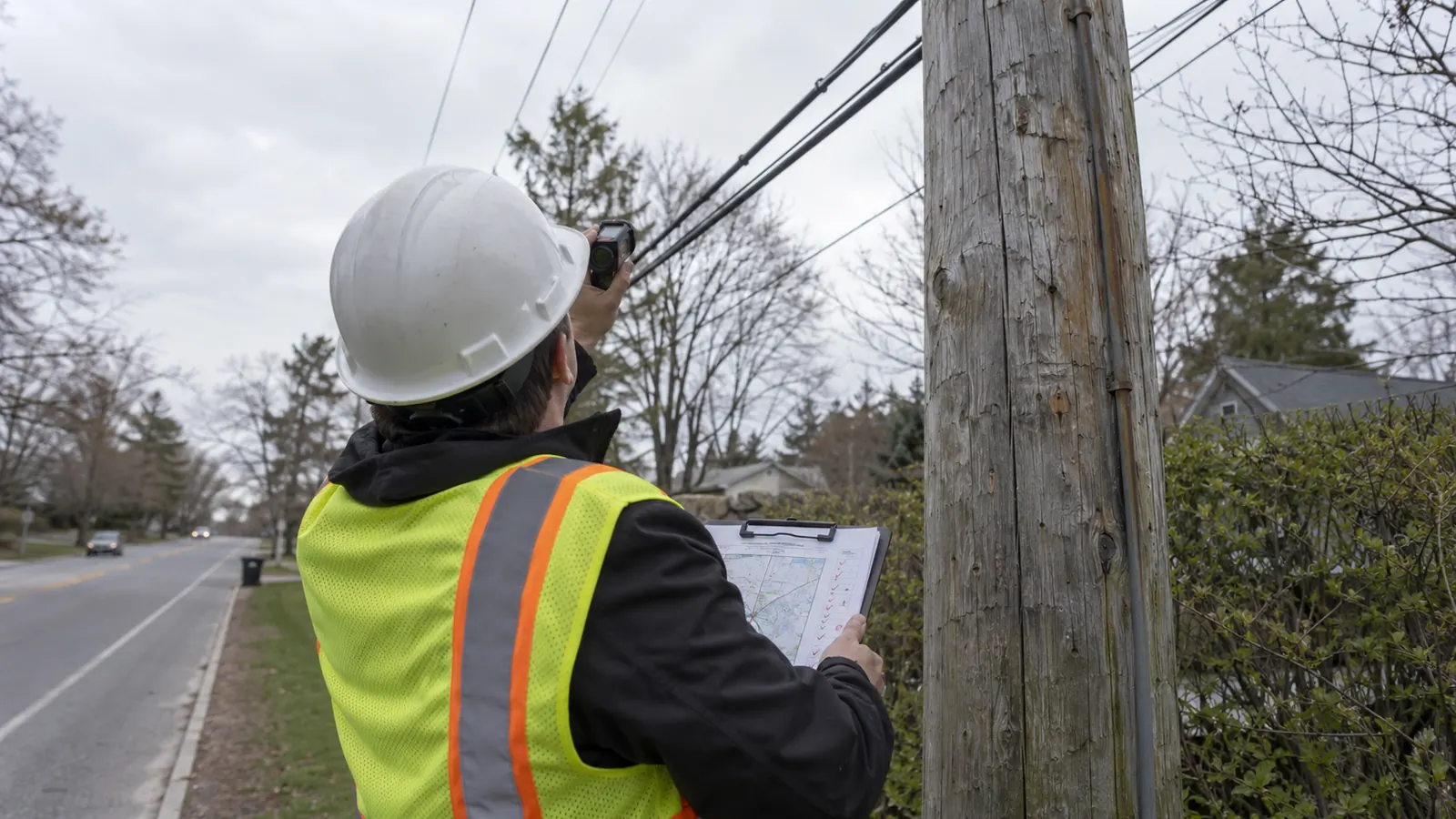
OSP fielding for overbuilder projects evaluates existing infrastructure for a competing network's proposed route. We assess 4 route options: existing pole attachments or conduit occupancy, new underground construction or a different corridor. The field package supports that choice by separating measured conditions from assumptions that still require an asset owner's response.
The first question is continuity. A favorable pole line means little if the route cannot reach the intended network tie-in or cross the last property boundary before the serving area. We work outward from those connection points so the survey follows a usable path, rather than collecting isolated assets that happen to be easy to reach.
Start with the operator's proposed service boundary
A competitive build needs a defined footprint. Ask the operator to identify the addresses it intends to reach and distinguish the first construction area from later expansion. We use that boundary to test how the route approaches each distribution area. Competitor coverage can inform the commercial decision, but the field assignment must follow the proposed network, including access to its connection points.
Existing plant also needs a clear relationship to the applicant. An incumbent upgrading its own network may have occupancy records that an entrant cannot obtain. An overbuilder should therefore identify which records it owns and which came from a prospective lessor. We keep the source attached to each record, because an inherited drawing can help locate a structure without establishing the right to occupy it.
Give the crew a question it can answer
Define the required observations before mobilization. If the decision concerns aerial reuse, the field scope must produce the geometry and equipment information the loading engineer needs. If conduit reuse drives the estimate, the scope must say whether authorized interior inspection and pathway testing are included. A surface walk cannot quietly become a commitment to either task when the crew reaches a locked structure.
Apply that discipline to unresolved records. We recommend keeping 1 persistent project identifier for each observed asset and recording the owner's identifier separately. A replacement pole can retain a nearby tag reference while its geometry changes. Our record needs enough context to distinguish the physical asset from the label used in an older attachment application.
Judge survey completeness against those questions. A folder full of photographs may document every visible structure yet omit the span that crosses the road. We want the field lead to identify that gap while a return visit is still being planned, with its effect on the route choice stated plainly for the project manager.
Compare Reuse Options Before Committing the Alignment
The shortest corridor deserves scrutiny when its savings depend on an unconfirmed attachment or an assumed spare duct. We compare it with an alternate that reaches the same useful endpoints. That comparison needs consistent limits: a route ending outside the target neighborhood cannot be credited with the same service reach as one that includes the approach and distribution entry.
We prefer targeted investigation over equal effort everywhere. That preference has a weakness: an early assumption about the tie-in can steer the entire survey toward the wrong corridor. Before concentrating field effort, we ask the operator to confirm that connection point and its access conditions. If it changes, we revisit the route comparison instead of preserving sunk survey effort as a design constraint.
The table frames each option's decision. Its outcomes are recommendations for further design or investigation, not construction releases. An operator can select an aerial alignment for application preparation while keeping a short underground bypass open, provided the estimate clearly identifies which parts depend on another party's response.
| Route option | Field evidence | Unresolved dependency | Decision supported |
|---|---|---|---|
| Existing pole attachments | Pole identities, span geometry and attachment observations | Owner review and required make-ready | Prepare attachment design or investigate a bypass |
| Existing conduit occupancy | Structure locations and authorized pathway findings | Occupancy rights and usable capacity | Pursue reuse or replace the assumed pathway |
| New underground construction | Surface constraints and crossing locations | Subsurface investigation and permit conditions | Develop a feasible new alignment |
| Different corridor | Continuity to the same connection points | New access conditions and service-area reach | Retain or promote the alternate |
Existing pole attachments
Aerial fielding must follow the spans. We collect pole identification and the required attachment geometry, then reconcile neighboring records so the proposed cable has a continuous path. Crossings deserve particular attention because the controlling condition may sit between poles. The engineer needs observations tied to the actual span, with the measurement method recorded wherever it affects how the input can be used.
Visible space does not establish structural capacity. We flag apparent conflicts for engineering review without assigning a final make-ready solution from a roadside photograph. A proposed new attachment can affect loading and clearances beyond the location where it appears crowded. Missing inputs should remain visible in the design issue list until the responsible engineer has resolved them.
Existing conduit occupancy
Matching lids alone cannot establish conduit reuse. We associate the structures at both ends of the proposed segment and document what access was permitted during fielding. If the owner has not authorized opening or testing, the package should state that limit. The designer can investigate a reuse option while leaving continuity and available capacity unconfirmed.
A pull rope or an apparently empty entrance is only part of the evidence. The proposed cable must suit the pathway and its installation limits, and the owner must permit the intended use, so we ask for pathway verification appropriate to that installation instead of converting a visible opening into a cable assignment. The receiving structure also needs workable space for the planned cable handling.
Investigate New Construction and the Alternate Corridor
New underground construction can remove a dependence on leased conduit while introducing a different set of constraints. Existing utilities still occupy the corridor. We record visible structures and surface conditions for the proposed alignment, and we identify the locations where a conflict could change the construction method. The investigation should follow the design risk at those locations.
New underground construction
The Federal Highway Administration's Subsurface Utility Engineering overview, updated November 1, 2022, describes 4 utility information quality levels, from D through A. Records alone represent QL-D; surveyed visible features correlated with records support QL-C. QL-B uses appropriate surface geophysical methods, while QL-A involves nondestructive exposure. We specify the investigation needed at a conflict rather than assigning a higher quality level to an attractive map.
That distinction matters at a congested crossing. A surface survey can establish where a visible structure sits, but the proposed bore or excavation may need subsurface information at the conflict itself. We carry that need into the investigation scope, distinguishing inherited records from field evidence before either enters design and flagging locations where the proposed method needs more information.
Different corridor
An alternate should remain credible long enough to influence the decision. We check its approach to the same serving area and identify its controlling crossing, rather than drawing a parallel line and assuming equivalent access. If it requires a different tie-in, that change goes back to the operator because it can affect network architecture even when the route appears easier to construct.
Preserve the reason for each route recommendation. An aerial route may be shorter but depend on extensive make-ready; an underground alternative may avoid those attachments but require a difficult crossing. Describe dependencies without inventing completion dates. The operator can then weigh field findings against its own budget and the launch sequence it is willing to support.
Separate Attachment Access from Field Completion
The owner review begins with the correct owner. We confirm the receiving entity for each application instead of relying solely on a pole tag or a name carried forward from an old drawing. Because ownership changes can leave useful physical labels behind, the project record must connect the observed asset to the party that currently handles requests for attachments.
Confirm the governing access process
Section 224 of the Communications Act, codified at 47 U.S.C. 224 and amended by the Telecommunications Act of 1996 on February 8, 1996, provides the federal statutory framework for covered pole attachments. Its coverage has limits, including exclusions for cooperatives and government-owned entities, and it recognizes state regulation of covered matters. We establish the applicable process before putting an access deadline in the schedule.
Our schedule separates the field delivery from the owner's application process. We record the submission state and the outstanding response for each affected route segment. Completion of an applicant's field survey does not, by itself, start every regulatory clock or settle an incomplete application. The project manager needs the applicable current requirements and a documented application history before treating a date as enforceable.
Make-ready findings also need clear attribution. A field observation, an engineering recommendation and an owner-approved scope carry different authority. We preserve those distinctions as the work develops so a preliminary allowance cannot be mistaken for a construction instruction. For the commercial discussion that follows, our pole attachment negotiation guide for ISPs explains how an organized application record supports questions about terms and scope.
Carry the blocked connection forward: When an unresolved attachment controls entry to the serving area, show that dependency on the route map used in schedule meetings. A separate issue log is easy to overlook when everyone is looking at the alignment.
Keep the design connected to the evidence
Once the route option is selected, we pass its constraints to the designer with stable asset references. A changed pole or a rejected conduit segment can alter the approach to a cabinet and the associated cable quantities. The overbuilder HLD-to-LLD release process takes those verified route decisions into detailed network design without treating a survey recommendation as final access authority.
That handoff is where our ISP network engineering work connects field findings to the operator's build plan. The designer should be able to trace a route exception to the relevant observation and see who must resolve it. If the evidence has changed since the survey, we reopen the affected decision before issuing drawings that depend on it.
Release Useful Segments Without Hiding the Gaps
A competitive launch benefits from a connected construction sequence. Surveying most of a route does not make that same share independently buildable. We review the path from the accepted connection toward the service area and identify the dependency that controls each proposed release. A short unresolved crossing can determine whether a much longer completed segment will serve any customers.
Review the record before the crew leaves
Field QA should test usability while observations are still recoverable. Review the exceptions first. We check whether a designer can follow the asset references across the route and find the photographs associated with a disputed feature. Our fiber node location mapping checks address coordinates and asset references at network connection points. A coordinate without its reference system may land in the wrong place. A clear photograph without an asset reference can be just as difficult to reconcile when similar poles repeat along the corridor.
The review must also accommodate change. We retain the survey date and flag later observations that replace an earlier condition, especially where another operator's make-ready or a utility replacement changes the plant. Revisit the affected location when its original evidence no longer supports the decision. A uniform expiration period for every observation would hide those differences.
Check the shared bottleneck: Before describing an alternate as independent, compare its controlling crossing with the preferred route. If both require the same unresolved access, moving the alignment has not removed that schedule dependency.
Distinguish a design release from construction readiness
We recommend separate decisions for releasing detailed design and authorizing construction. Detailed design can proceed with a bounded assumption when its owner and consequences are explicit. Construction release requires the applicable permissions and completed prerequisites for the work being assigned. The construction readiness review addresses that later decision, including the conditions that remain outside a fielding package.
Report progress in terms the operator can use. Show the route segments ready for the next defined activity and identify the specific issue holding the rest, avoiding a single completion percentage that combines surveyed mileage with attachment approval. Those measures answer different questions, and mixing them encourages a launch commitment the underlying records cannot support.
Scope OSP Fielding for Overbuilder Projects Around the Next Decision
For an ISP entering a new market: Confirm the tie-in and field the controlling route constraints before committing to a service-area launch sequence. Keep an alternate under review where the preferred alignment relies on unconfirmed reuse. The first investment should answer whether a connected build can reach the chosen addresses, rather than maximize the amount of corridor photographed.
For an operator with an established attachment program: Match the collection scope to the receiving owner's current application requirements. Spend additional effort on changed plant and unresolved span geometry. Existing agreements can simplify coordination, but the proposed cable still needs a defensible engineering basis and the required authorization for the specific facilities it will occupy.
For a project manager preparing construction packages: Require the survey handoff to identify the evidence supporting each route decision and the dependencies still open. Release work in connected segments whose prerequisites are satisfied. That approach gives the construction team a usable boundary and keeps an unresolved attachment from disappearing inside a broadly labeled design milestone.
Discuss your overbuild fielding scope with our engineering team. Start with the corridor that controls your proposed launch.
Draftech brings those route constraints into one engineering assignment, with 100% in-house engineering and full turnkey construction delivered by Draftech-managed subcontract crews. We connect the observed plant to the proposed design so the operator can resolve access questions before they become field changes. Active in 24 states. Available across all 50 U.S. states. Send the proposed overbuild boundary and your open reuse questions to info@draftech.com.
For an overbuild that needs a sound route decision before a larger commitment, consider Draftech's free engineering offer. Draftech engineers the first 20,000 linear feet of a qualifying route at no cost, from feasibility and field survey through permit approval. The owner reviews each request before Draftech commits the package, so the proposed corridor and its unresolved access conditions belong in that request.