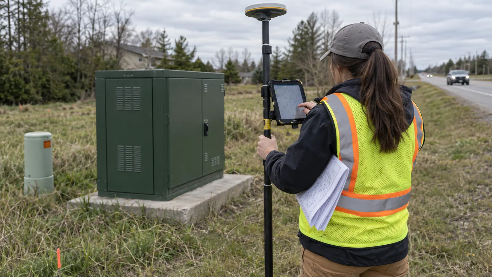
A precise coordinate can still send a technician to the wrong enclosure. The receiver may have measured the point correctly while the field record attached it to a neighboring cabinet, or the office may have replaced an observed location with an older design symbol. More decimals will not repair either mistake. We need the physical asset and its network identity to agree before the map becomes an operating record.
This guide covers physical nodes, cabinets, FDHs and splice points from collection through as-built acceptance. We focus on the decisions that affect whether another person can find and identify the same asset. Software selection is outside that task. The useful question is whether the delivered record explains what was measured and gives the receiving engineer enough evidence to accept it.
Tips for accurate fiber node location mapping start with the asset
Tips for accurate fiber node location mapping are field and office checks that connect a measured position to the correct network asset. For the 4 asset classes covered here, nodes, cabinets, FDHs and splice points, accuracy depends on both the coordinate reference and verified identity. A precise position alone does not establish connectivity.
Decide what the point represents
The mapped feature needs a physical definition. A cabinet footprint, its door and a receiver held beside it occupy different positions. We recommend agreeing on the collection point before mobilization and carrying that definition into the field form. Where the specified point cannot be occupied, the record must explain the offset method rather than quietly treating the observer's position as the cabinet location.
An FDH can be housed inside a cabinet that has its own structure identifier. Keep those relationships explicit. We would retain the housing record and associate the FDH equipment record with it, following the operator's data model, instead of creating unrelated coincident points that future editors could move independently. The same distinction matters when a splice closure sits inside a handhole: locating the lid does not by itself locate the closure within it.
Separate physical location from network assignment
A node name is not a location measurement. An HFC service group can change while the housing stays in place. We keep the physical asset identifier separate from the logical assignment so a network reconfiguration does not create a false relocation history. Our discussion of node segmentation and physical boundary changes explains why those records need separate treatment when an operator changes the population served by a node.
Splice points need the same discipline. A line crossing a point on screen does not prove that the cable enters that closure, and proximity is not evidence of a splice. Where a connection cannot be confirmed from authorized observations or accepted records, preserve the uncertainty. Do not make the topology look complete by drawing an unverified relationship. We want an honest exception that can be resolved, not a tidy map that conceals one.
Match GPS grade and datum to the delivery requirement
Specify the result before choosing the receiver
Receiver grade is a procurement input, not an acceptance result. GPS.gov's reference page, GPS Accuracy, explains that user accuracy depends on receiver quality and the conditions under which signals arrive, including blockage. That is why we start with the operator's intended use and required positional performance. A device suitable for finding a roadside asset may not meet the requirement for engineering a constrained installation.
Ask the receiving team to define how positional acceptance will be demonstrated before the survey starts. The requirement should distinguish horizontal position from elevation when elevation is in scope, and it should identify the confidence basis for any stated tolerance. No universal threshold fits every route. We would not accept a receiver's marketing specification as proof that a particular point met the project's requirement under the conditions present at capture.
Keep the reference frame attached to the coordinates
Coordinates need their reference information. Record the horizontal datum and realization with the CRS definition; retain coordinate epoch where relevant to the project's reference frame. Units belong in the delivery specification too. NOAA's National Geodetic Survey identifies its Coordinate Conversion and Transformation Tool, NCAT, as a resource for coordinate conversion and datum transformation. Changing a dataset's label is not the same operation as transforming its coordinates.
Retain original observations through transformation. We need to be able to distinguish a corrected location from a different numerical expression of the same location. If elevation is required, state its vertical reference separately and document any geoid model used. A receiver height should never become a ground elevation merely because an export column was renamed during processing.
The checks below separate acquisition problems from record problems. Each requires a different correction.
| Check | Evidence to retain | Warning in review | Corrective action |
|---|---|---|---|
| Position and reference | Observation metadata and CRS definition | Shift after import | Check units and transformation before recollection |
| Asset identity | Field identifier and equipment relationship | Multiple assets share a label | Resolve identity with the operator |
| Photo association | Original image linked to the asset | Correct scene, wrong record | Trace the capture session and relink |
| As-built agreement | Field evidence and drawing revision | Design symbol conflicts with observation | Resolve the discrepancy before acceptance |
We treat field conditions as part of the measurement record. If a collection point sits under canopy or beside a reflective surface, note the condition and retain the available GNSS quality information with the observation. Record the correction method and solution status where the receiver provides them. Repeated readings are useful checks, but a cluster of similar readings does not independently prove absolute accuracy.
When direct occupation is unsuitable, the survey lead should select a documented method that meets the delivery requirement. That can involve a measured offset or different survey equipment, depending on access and project control. We do not recommend moving into an unsafe position to improve a receiver display. The resulting record must distinguish the occupied position from the derived asset position so an office reviewer can reproduce the relationship.
Verify identity and build the attribute record
Confirm the label before leaving the asset
Field identity must survive the trip back to the office. Read the installed identifier from a safe, authorized position and compare it with the work assignment. If the label is missing or illegible, retain a provisional record with the condition stated. Do not borrow the nearest known identifier simply to complete a required field. That shortcut can overwrite a neighboring asset.
We recommend checking the identity while the collector can still compare the physical asset with the record on the device. After departure, a discrepancy can force another visit even when the coordinates themselves are usable. Photograph the identifier where permitted and associate it with the observation immediately. Where opening an enclosure requires operator authorization, record the access limitation instead of inferring unseen equipment from the outside of the cabinet.
Make unknown values distinguishable from empty fields
Attribute standards should describe meaning, not just spelling. The operator should define valid asset classes and lifecycle states before collection. Proposed equipment must remain distinguishable from installed equipment, even when both occupy the same planned location. We also recommend keeping the physical asset ID stable through a name change, with the old designation retained as an alias when the operating system supports it.
An empty value is ambiguous. It might mean that the collector did not check, that access was unavailable or that the attribute does not apply. We use explicit exception values where the receiving schema permits them and retain explanatory notes when it does not. The point is to prevent an import routine from turning missing evidence into an apparently verified default. A blank port assignment should not become a spare port by assumption.
Collection metadata belongs beside the asset attributes, with the observation time and collector identity retained through export. The reviewer also needs the source of the position, whether measured in the field or carried forward from an accepted record. Test a small import before expanding collection. Confirm that IDs remain text where needed and that leading zeros survive the receiving system's field conversions.
For an operator coordinating survey work with a network expansion, our ISP network engineering services connect the asset model to the design handoff. We keep engineering 100% in-house. The practical benefit is continuity between the field definition and the record the design team actually consumes, so a cabinet cannot change meaning simply because it moved from a collection form into a drawing.
Review geometry without inventing connectivity
Spatial checks find candidates for investigation. Duplicate coordinates can represent valid equipment within a shared structure, while separate coordinates can still refer to the same asset collected twice. Review both cases against identifiers and field evidence before merging records. We would also investigate a point that falls across a road from its accepted access description, but the map image alone should not decide which record is wrong.
The same restraint applies to topology. An automated snap can make a cable endpoint coincide with a cabinet symbol without establishing the actual entry. Use the operator's connectivity rules and accepted splice records to confirm the relationship. Our guide to governing broadband network GIS mapping addresses the broader release controls; here, the essential check is whether the mapped connection has evidence beyond its appearance on screen.
Use photos and as-builts to resolve disagreements
Photograph the association, not just the enclosure
A useful photo answers an identification question. An overview can show the approach to a cabinet, while a detail can show its installed label. Link each image to the asset record with a stable reference and preserve the original file. If the association depends only on the order in which images were uploaded, a later re-sort can separate the evidence from the point it was meant to support.
Photo location metadata is supporting evidence. It describes the camera position when available, which may differ from the asset position. We recommend checking that distinction whenever a photo is used to challenge a surveyed point. A clear view of the enclosure can support identity without supporting a precise coordinate, particularly when the picture was taken from across a road or from outside a restricted compound.
Keep access notes useful to the person returning to the asset. Record the approach and any observed access restriction without placing sensitive operating details in a broadly shared map. Photographs containing identifiable people or unrelated private information need handling under the operator's rules. We also separate public illustrations from the operational evidence package; an article image is not proof of a surveyed location.
Preserve the original observation: When a photo challenges a plotted point, investigate the association before moving the geometry. A misplaced photo attachment can look like a survey error.
Reconcile revisions without erasing the field history
An as-built label does not settle a disagreement. Compare the drawing revision and its supporting construction record with the collection date. If a cabinet was relocated after the survey, the later accepted evidence can explain the difference. If no relocation is documented, the discrepancy remains open. We should not overwrite a measured point merely because the conflicting document arrived in a more polished package.
Our preference for field verification has a limitation: a field visit cannot confirm equipment the observer cannot safely access. State that limit in the deliverable. An exterior photograph may support the location of a locked cabinet while leaving its internal assignments unverified. Treat those as separate acceptance questions, and direct the unresolved assignment to the operator rather than presenting the whole asset record as equally certain.
Where a change is supported, preserve the previous geometry in the revision history and attach the reason for the correction. Check whether the change affects associated cable records before releasing it. Moving a closure symbol without reviewing its parent structure can leave the map internally inconsistent. The accepted drawing and GIS export should describe the same physical condition, with any deliberately different representations explained in the handoff.
For the final package, our fiber as-built deliverables for ISP acceptance guide covers the receiving operator's decision. The location record should travel with its evidence rather than depend on the surveyor being available to explain it later. Unresolved items need an assigned reviewer and a clear next action, so a missing identifier does not disappear into a general closeout comment.
Apply these tips for accurate fiber node location mapping at release
For an ISP building new plant, establish the asset definition before the first production collection and test the receiving import while changes are still inexpensive. Keep proposed points separate from verified installation records. We recommend checking changed locations as construction progresses, because waiting until closeout makes it harder to distinguish a field relocation from an office edit that never reached the workfront.
For a carrier maintaining an existing network, prioritize unresolved identity and location conflicts on assets that operations must access. Preserve installed identifiers during data cleanup. Bulk renaming may make a database more uniform while making it less recognizable to the technicians who use the field labels, and a clean naming convention is not worth losing the relationship between the map and the enclosure.
For an engineering team accepting a handoff, test the delivered records in the receiving environment before signing off. Open the linked photographs from that environment and confirm that the exported CRS is interpreted correctly. We would reject a package whose evidence works only on the producer's workstation. Acceptance needs to cover the usable delivery, including any unresolved exceptions the owner has expressly agreed to retain.
Our engineering and turnkey construction services address the gap between uncertain asset records and a route ready for delivery. Engineering stays in-house; full turnkey construction is delivered by Draftech-managed subcontract crews. Active in 24 states. Available across all 50 U.S. states. If mismatched cabinet IDs or conflicting as-builts are holding up your route, describe the problem at info@draftech.com so we can identify the engineering work needed.
For a qualifying route that needs its field evidence carried into design, request Draftech's free design review: Draftech engineers the first 20,000 linear feet at no cost, from feasibility and field survey through permit approval. The owner reviews each request before Draftech commits the package. That review establishes whether the route fits the offer before we undertake the work.
Resolve the mapping handoff: Talk to our engineering team about your route.