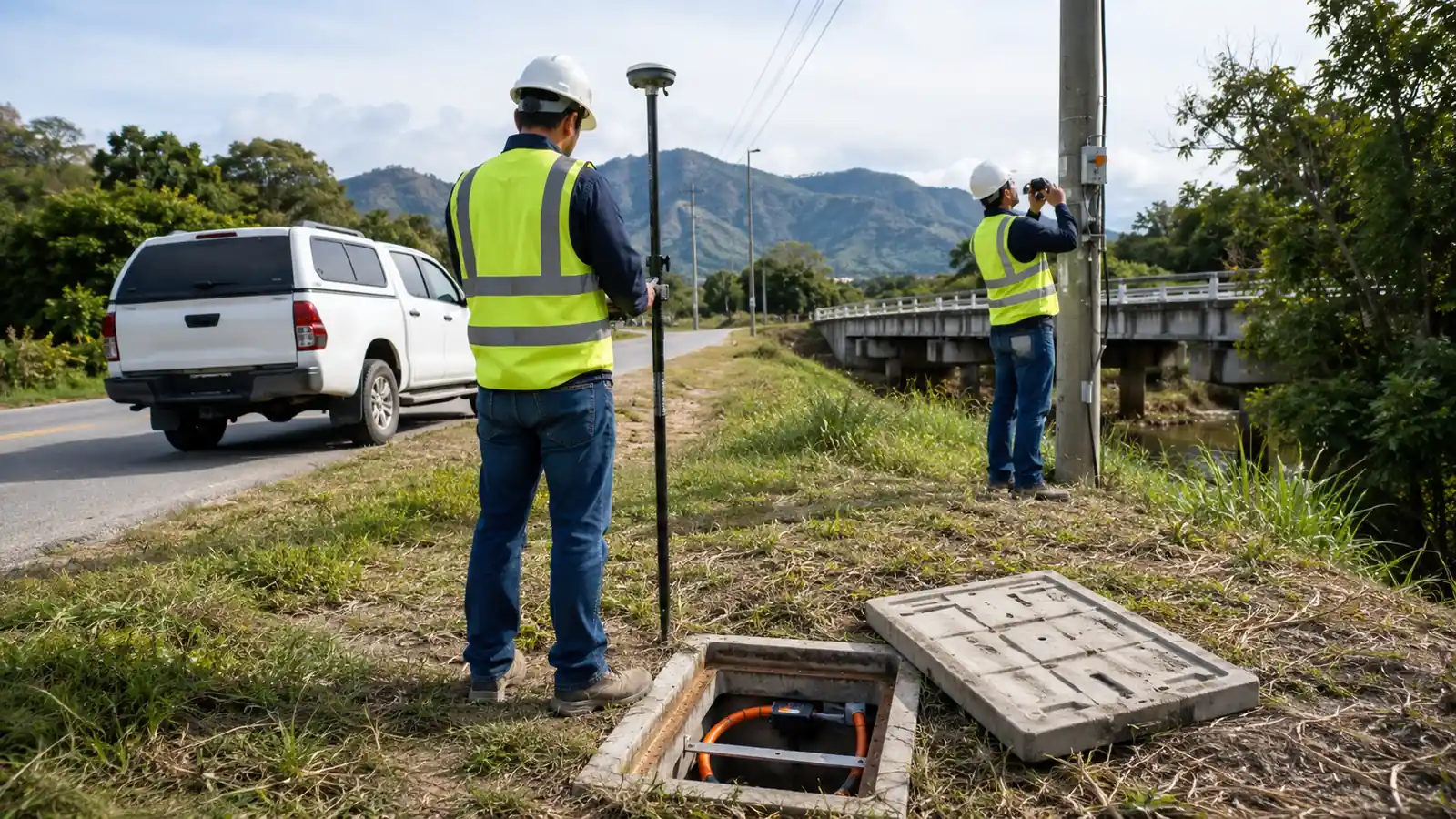
Inherited OSP records often look more certain than the assets they describe. A line on a drawing does not prove conduit continuity. A handhole symbol does not prove access. A pole point does not prove ownership or attachments. Nor does it prove the span relationship. The survey must show where records agree with physical evidence or conflict with it. It must also mark unresolved areas.
This guide starts with the reuse decision, then maps evidence depth across aerial plant and underground structures while keeping utility context, right-of-way limits, position quality and field-to-design QA visible. We do not promise that every unknown can be resolved in one visit. We require every remaining unknown to stay visible and owned, with a release condition attached.
OSP Existing Infrastructure Survey Scope and Evidence
An OSP existing infrastructure survey is the controlled verification of assets, routes, access, utility relationships, and record confidence for a design or reuse decision. Our 6 evidence groups cover scope and aerial plant; underground plant; jurisdiction; position; condition, allowing designers to separate observed facts from supported records and assumptions reliably. Unresolved questions remain open.
The correct survey depth depends on the decision. A planning team asking whether an existing corridor is broadly viable needs different evidence from an engineer deciding whether a specific duct or pole can enter construction design. Cabinet, bridge attachment and handhole decisions may demand different evidence. We write acceptance questions by asset class before configuring the form. Collection that does not answer a defined decision can produce thousands of accurate points, yet the resulting dataset can still fail the engineering question that justified the project.
Our 6-group framework is Draftech's recommended scope map, not an industry statistic. For each group, we define the expected record and accepted collection method. We also set confidence categories, photograph coverage and the exception path, followed by receiving discipline. The survey package must tell engineering what can be used under the approved method, which assets need targeted verification and which conclusions remain unsupported until their evidence changes. That last category is a valid deliverable when it is explicit.
Safety limits are part of scope. The OSHA Telecommunications standard, 29 CFR 1910.268, is a named federal reference for telecommunications work. The employer's approved procedure and worker qualifications govern the crew throughout the assignment; traffic controls apply; access authorization and changing site conditions set further limits on collection. We never ask a collector to enter a space outside the approved method. We do not authorize climbing, plant manipulation or approach to a hazard beyond that method.
Before mobilization, our field survey workflow aligns the engineering question, source records, route limits, collection schema, safety plan, coordinate requirements plus evidence coverage and daily QA. This prevents an office reviewer from changing the meaning of a required field after crews have left the corridor and the original observation can no longer be checked efficiently. It also gives the crew a controlled exception option when the physical condition does not fit expected choices, instead of forcing an unsupported value into the receiving dataset.
The trade-off in our preferred evidence-first approach is extra setup before mobilization. We accept that burden because a form built around an undefined reuse decision only moves uncertainty downstream. Define the decision first. Then collect.
Evidence Groups and Release Rules
Each evidence group receives a release rule. A segment can pass route context while remaining blocked for conduit continuity or ownership. We preserve that segmented status so one unresolved structure does not stop unrelated review, but the unknown cannot silently flow into design. The table is a preview map for the field and QA controls explained in the following sections.
| Evidence group | Field question | Required record | Release rule |
|---|---|---|---|
| Scope and route | Which decision and corridor are in scope? | Limits, source records, acceptance questions | Every segment assigned |
| Aerial plant | Do poles and spans form a reusable route? | IDs, ownership, attachments, guys, continuity | Both span ends reconcile |
| Underground plant | What structures and pathways are evidenced? | Structures, visible ducts, occupancy, method | Visible facts separated from tests |
| Jurisdiction and access | Who controls the asset and work area? | Owner, right-of-way, access, permit context | Dependencies assigned |
| Position and metadata | How defensible is the location? | Coordinate method, CRS, units, offsets, confidence | Accuracy fits decision |
| Condition and exceptions | What limits reuse or further review? | Observation, image, status, impact, next action | Unknowns remain visible |
The table deliberately separates visible evidence from intrusive or specialized verification. Opening an authorized handhole can establish what is safely visible at that structure. It does not by itself prove that a duct continues to the next structure, nor can that observation establish whether the pathway is suitable for the proposed installation. Because each method supports a different conclusion, records or locating may be needed before specialized rodding or mandrel work is authorized under the approved scope.
- Observed fact: a condition directly recorded by the approved field method with indexed evidence.
- Supported record: owner or project information accepted for use and linked to its source revision.
- Approved assumption: a stated design basis with scope and consequence, plus named authority and review status.
- Open exception: missing or conflicting evidence with an owner and impact, plus a defined closure event.
These 4 evidence states are another Draftech control framework, not a measured data-quality claim. We keep them distinct in the source dataset and in exports. A symbol color alone is not enough because color can disappear in a print or CSV. Model imports can erase it too. Status, source, method, confidence, and exception ID should travel as attributes or connected records wherever the receiving format allows.
Survey Aerial and Underground Infrastructure
Aerial survey begins with connected route order. We record pole identity, owner evidence, material, observable condition, existing communications attachments, risers, equipment, guys, anchors, crossings and access. The relationship to neighboring structures stays explicit. A pole-by-pole inventory can look complete while the route is wrong. Every span must reconcile from both ends or carry an exception. Our strand mapping and aerial plant assessment process expands that corridor-level review.
The field record should not convert observation into structural conclusion. A collector can document visible damage or unusual movement within the approved scope. Decay indicators, hardware condition and access obstruction remain observations rather than engineering conclusions. Engineering or the pole owner determines required analysis and disposition. We keep the original observation and image with its location. Method and escalation state stay attached. Labels such as good or bad are weak unless the project defines exactly what evidence and authority they represent.
Underground survey starts with structure identity and safe access. We record handholes, vaults, pedestals, cabinets, lids, visible interior dimensions, duct count and direction, apparent occupancy, plugs, water, debris, damage, and method limitations when those observations are authorized. The package distinguishes what was visible without disturbing plant from results produced by locating or rodding. Mandrel work, pull testing and any other specialized method remain a separate scope. Method metadata sets the confidence boundary.
Conduit continuity is a relationship claim, not a point attribute. A visible duct entering one wall does not prove its destination or internal condition. Availability remains a separate conclusion. We link source records and field observations to each candidate segment, then assign one status. Evidence may support or contradict the segment. Otherwise it remains unresolved until a named approved method verifies it. The designer can then choose a route, request targeted verification, or retain an alternate without treating a hopeful line as existing infrastructure. Scope first. Evidence second. Reuse decision last.
Structure photographs need both context and detail. A lid image can establish surface condition but not the surrounding route or traffic exposure. An interior image can show visible ducts but may not establish which direction they travel. We use an indexed sequence tied to the asset and orientation. It also records observation time and collector. File names alone are fragile. The database relationship should survive export and remain usable by engineering and QA reviewers.
Access failures must identify exactly what could not be observed and why. Locked structures, unsafe traffic exposure, vegetation, water, parked vehicles, property restrictions, and unapproved entry conditions create different follow-up actions. We do not mark the whole asset missing if its location is known but its interior was not inspected. Granular exception states allow a records request or return visit to target the unresolved attribute.
Continuity caveat: One open handhole proves only the evidence visible there. Record the method before claiming anything about the next structure.
Jurisdiction, Position and Field QA
Physical reuse and legal availability are separate decisions. We identify apparent asset owner, roadway or parcel context, access controls and locate markings. Easements supplied in the project record remain linked to jurisdictional transitions. The FHWA Utilities Program is a named federal reference for utility accommodation and relocation in highway programs. The controlling road authority and utility govern a specific segment through the applicable permit, agreement and property record.
An owner and jurisdiction matrix begins during survey planning and stays tied to route segments. It names the apparent controlling entity with its evidence source and confirmation status. We also assign the project contact path, required decision and responsible coordinator. A pole or duct can be physically attractive and still unavailable to the design. Our map must show both the asset and the approval dependency so engineering does not complete a route around an unconfirmed right.
Position quality must fit purpose. We record collection method with the coordinate reference system and units. Expected confidence stays beside the offset method, applicable control point and source of any desktop location. Phone-derived points, approved mapping GNSS, survey-grade observations, and digitized records should not appear equally certain simply because they share decimal places. Our field survey data accuracy guide connects positional metadata to design consequence.
We reserve higher-accuracy methods for assets whose exact position affects conflicts, design geometry, permits, or construction control according to the approved scope. Lower-consequence inventory can use another accepted method when the owner understands the limit. This risk-based approach does not authorize vague accuracy claims. Every feature carries enough metadata for the receiving engineer to decide whether its position supports the intended use.
Daily QA begins with schema completeness plus the evidence relationship. Corridor continuity is a separate gate. At the end of each shift, automated checks can flag required blanks plus duplicate IDs and invalid domains, while a qualified reviewer examines missing photographs, coordinate outliers and broken references in corridor context. A qualified reviewer must still decide whether the image supports the attribute, whether adjacent assets connect, and whether an exception can change route or reuse decisions. These are Draftech review gates, not a claim about universal practice.
Correction requests should be actionable while crews remain near the segment. We name the asset with its disputed field and existing evidence. The request states why it fails, acceptable closure evidence and priority. A note saying verify handhole is not enough. A request that identifies unmatched duct directions and asks for authorized orientation photographs is specific. The corrected record keeps revision history so later users can see why the accepted value changed.
Field software supports this process only when its forms and permissions preserve meaning; sync controls remain visible; evidence links survive export. Our telecom field data collection software comparison explains how to test those controls. A required field can reduce blank values, but it can also encourage guessing when no exception choice exists. Good configuration makes unknown and inaccessible legitimate states with required follow-up.
Accuracy rule: Store method and confidence with the feature. Decimal places are display, not proof of positional quality.
OSP Existing Infrastructure Survey Handoff Decisions
Planning team screening an inherited corridor: Release route context by segment, but hold any reuse claim whose ownership, continuity, access or position evidence is not fit for the planning decision. Do not let a complete-looking map turn open questions into design facts. Release by segment.
Design manager preparing construction documents: Require named closure evidence for every duct, pole, structure and jurisdiction dependency that controls geometry or constructability, then test one representative asset through the receiving CAD or GIS workflow before approving the survey package. No silent assumptions.
The survey release should answer reuse questions by segment and asset class. We classify evidence as accepted for design or accepted with a stated limitation. Other evidence is held for targeted verification or excluded from the current decision. Each held item names the design consequence and closure action. This allows engineering to advance defensible portions of the route without inheriting unsupported certainty in the unresolved portions.
A controlled handoff includes native data, an indexed photograph set, source-record register, route map, coordinate and unit metadata, asset relationships, condition observations, owner and jurisdiction matrix, exception log plus revision history and QA approval. We test at least 1 representative asset through the receiving CAD or GIS workflow. The design handoff must preserve the same record. Correct source data is not enough if export strips IDs or methods. It must also retain evidence links and status.
The final map should show where evidence changes, not smooth those boundaries into one line. We retain route breaks and crew limits; source changes; jurisdiction transitions; inaccessible structures; conflicts between records and observation. Our fiber network as-built GIS documentation standards explain how these controls support later lifecycle records instead of creating another disconnected survey layer.
Draftech's field delivery team carries field evidence into 100% in-house OSP engineering and GIS; design; permitting; documentation. When construction is included, it is delivered full turnkey through Draftech-managed subcontract crews under our QA/QC and safety oversight. Our field survey service removes the handoff gap among collection schema, route evidence and design decisions. It also aligns exceptions with final records.
If you need to define reuse questions, collection methods, or acceptance rules before fielding, email our survey team. We can identify where existing records are sufficient, where field evidence is needed, and where a specialized verification scope should remain separate.
Talk to our field survey team about your route. We can align asset evidence with safe collection methods before mobilization. Exceptions and engineering release rules stay explicit.