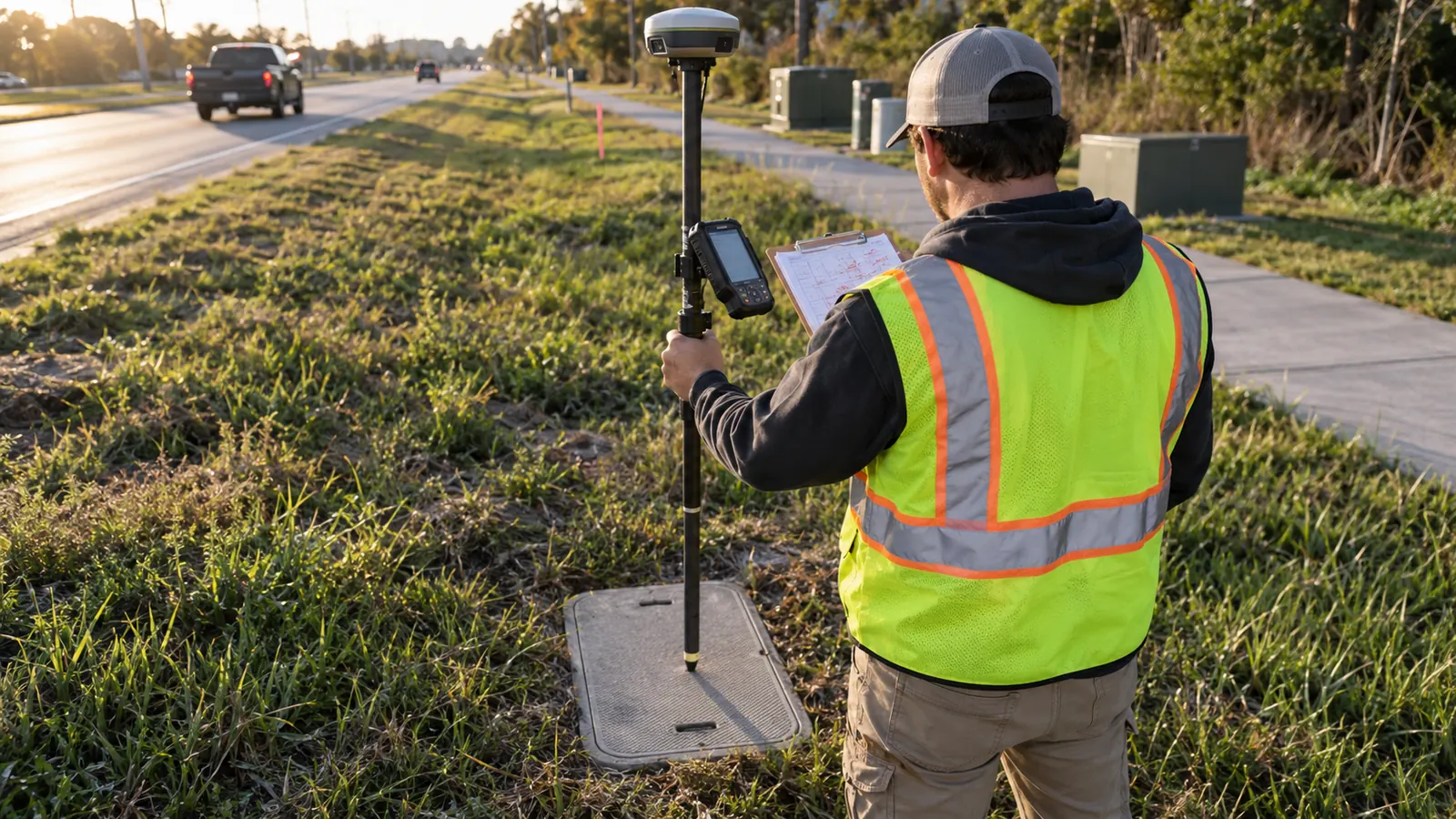
A handhole moves around an obstruction during installation. An attachment transfers to a replacement pole. The route may be ready to carry service, yet the drawings still show where we intended to put it. Before accepting that section, we need those changes recorded while the people who made them can explain what happened.
For an engineer accepting telecom or power infrastructure, that means checking which details have field evidence behind them. Here we cover verification of installed assets and the information it supplies to drawings and GIS, especially the depth and route details that become harder to check once construction covers them.
What as-built surveys establish
On telecom and power infrastructure, as-built surveys are post-construction field checks of installed plant against design, feeding 2 record forms: as-built drawings and GIS. They verify asset locations and physical details, while carrying forward supported depth and footage records so the owner can distinguish installed conditions from proposed work.
Back at the desk, we use the field observations to update drawings and tie GIS entries to assets someone can find again. A line may look complete on the map even where no one checked the route. We follow the recorded details back to their sources and flag the stretches those observations leave unanswered.
Installed plant has a different question to answer
Suppose an obstruction forced a fiber handhole away from its approved position. The field record should show where the crew installed it, even if the engineer has yet to accept the change. Recording that position gives us something to review; it cannot turn an installation deviation into an approved design change.
Pre-construction fielding establishes conditions for a proposed route, as explained in the construction site survey guide, while this work checks the plant after installation.
Be specific about what the scope means by survey. The utility verification covered here does not establish property boundaries or replace a licensed boundary or site survey. Where the receiving package requires that professional certification, the owner needs the appropriate licensed provider. Even carefully recorded utility coordinates leave the owner needing that separate certification.
A visible pole attachment can be checked during the visit, whereas a buried duct segment may have to be described using measurements taken during installation. We keep observed condition and recorded condition distinguishable within the package so the reviewer knows how each fact was obtained. Where neither source supplies the evidence, we identify the missing information.
Fiber and power share record needs, not identical attributes
For fiber, the record ties route segments to access structures and identifiable cable facilities. With electric distribution plant, the reviewer compares installed structures and equipment against the electrical design. We need the owner's asset identities alongside those equipment and structure relationships. Without them, an engineer looking at the layout has to work out which piece of plant each symbol refers to.
A power asset record may include a circuit association supplied by the owner, but a field observation alone cannot establish the operating state of that circuit or authorize work on it. We discuss power examples here to explain the documentation task. Draftech's service scope described below concerns installed fiber plant.
When to verify completed route sections
Before we send a field team to a completed section, we define where that section starts and stops using identifiable assets or clear route references. This matters when the adjacent segment is still under construction. The team needs to know which span is ready to check and where installation work could still change the route.
Follow the work without losing buried evidence
Post-construction verification should run as route sections finish rather than waiting for every part of the network to reach final closeout. A segment can be ready for a documentation visit even when another crew is working beyond it, provided its installed configuration is stable enough to record and its outstanding work is identified.
Once the plant is buried, a walkout can confirm visible features but cannot recover a concealed measurement just by following the planned alignment. Depth and other hidden details therefore need records made while the installation was accessible. In scoping our visit, we check which of those records are available and which questions a surface observation can answer.
Later work can send us back to a section we have already documented. If an enclosure moves after the visit, we reopen that section for review even if the register says complete. Otherwise, the next engineer will be working from the enclosure's old location, with nothing on the record to explain that it moved.
Keep incomplete sections identifiable
In the section register, show the limits of field verification and note any work the team could not observe. An inaccessible structure needs an explicit entry so the next engineer can see why its connection remains unchecked. A blank field leaves us wondering whether anyone inspected the asset at all, much less checked it against design.
Consider a hypothetical handoff between 2 completed sections sharing a handhole. Each record must identify that same structure and state which connected segment it covers. We check the join as well as each section: if the asset identities disagree or the coverage stops short, both packages may look finished while leaving a gap between them.
| Record group | Field verification focus | Question preserved for the owner |
|---|---|---|
| Route location | Installed path and observed changes in direction | Where does the segment run? |
| Recorded depth | Measurement source and reference surface | What depth evidence exists at this point? |
| Installed footage | Length basis and segment endpoints | Which length does this quantity describe? |
| Structures | Asset identity and connected plant | Which access point belongs to this segment? |
| Attachments | Host structure and installed arrangement | What occupies this support? |
What as-built surveys record against design
Give the field team the design baseline and the available construction records for the section. Against those documents, we can compare each observed asset and describe any deviation. For each detail, we show the result: it matched the design, it differed, or the team lacked the information needed to check it during that visit.
Location follows the installed route
When recording a position, identify what was measured. A point on a handhole lid establishes the position of that feature; it does not measure every duct beneath the lid. We identify the asset at each measured point and use installation evidence to document route changes beyond what we can see during the visit.
Imagine a hypothetical segment drawn as a straight line between 2 mapped structures, although installation took it around a bend or offset. We would carry the supported alignment change into the record and mark any stretch whose path remains uncertain. Connecting the endpoints on a drawing cannot tell the reviewer whether anyone observed the route between them.
Coordinate and photo standards should follow the owner's delivery requirements, with the recording conventions covered in our fiber as-built GIS documentation standards guide.
Depth stays attached to its source
For a depth entry, state where the measurement applies and the surface or feature used as its reference. Depth to the top of a duct, elevation, and distance to another feature describe different things. We check the reference as carefully as the number. A correctly copied measurement can still mislead someone who reads it as depth to a different feature.
Final grading can change the surface above the plant. A depth measured before that work should still say so when it reaches the finished asset record; otherwise it may be read as current cover. Where the evidence cannot establish installed depth, we identify the missing measurement so the owner can define the further verification needed to resolve it.
Keep the depth qualifier: carry the original measurement reference into the asset record so a later user can tell whether it describes the installation surface or the finished surface.
Footage needs a defined length basis
When checking footage, we ask whether the quantity follows the installed route or describes cable length, including slack and vertical transitions. Combining those quantities under an undefined label can leave maintenance with a repair estimate that disagrees with the cable available at the enclosure. Keep the length basis attached to the quantity so the reader does not have to infer it.
The endpoints also need to agree before anyone compares totals. Construction records may measure between structure faces, while a mapped line runs between representative points. We retain that distinction with the quantity and investigate differences that it does not explain. If we change a value merely to make the totals balance, the original basis disappears and the next person cannot check the comparison.
Structures connect the asset record
Check the identification on a handhole or cabinet against its design reference, then make sure the record shows the plant entering and leaving it. A replacement structure or changed position can make the drawing ambiguous. Our concern is practical: maintenance can have an accurate coordinate and still go to the wrong enclosure if the asset identity attached to it is wrong.
If the team cannot access a structure, we record the limitation alongside the location. Measuring a closed lid tells us where the enclosure sits, but leaves its cable connections unchecked. That location is still useful to the engineer opening the package, as long as the entry makes clear that the team could not inspect the contents.
When missing fiber records prevent that handoff, our as-built documentation for installed fiber plant covers field verification of missing records, GPS capture and GIS and CAD reconciliation. Before defining the visit, we identify the particular missing information it can recover, then judge completeness against that scope.
Attachments belong to an identified support
For aerial plant, tie the observation to the pole or support that carries the attachment now. A retired pole identifier can leave a field crew searching for an arrangement that has already been transferred. We check that the record takes someone from the old identifier to the replacement support. The crew may know where everything went, but a later visitor needs to find it from the record.
Describe the installed attachment arrangement within the observation scope, including measured attachment information where the owner requires it. The responsible engineer then needs the design review and acceptance evidence to decide whether loading and clearance requirements have been met. Our observations give that engineer an arrangement to review and, where necessary, to send back for correction.
Redline reconciliation carries supported field changes back into the design record while retaining unresolved differences for the owner's decision.
Accuracy tests belong in the acceptance method, and our guide to checking fiber as-built accuracy addresses that separate review.
Why the record matters after acceptance
An inspector compares the work with the planned installation. Later, a repair crew uses the same record to find the affected asset and work out how to reach it. When we review the handoff, we check whether the location and segment relationships will still answer those questions for someone who was absent during construction.
Repairs depend on the asset relationship
An enclosure location helps a crew reach the plant, but the relationship between that enclosure and the affected segment determines whether it is the right place to begin investigating. Where a route was diverted during installation, an unchanged drawing can point the crew along the abandoned design alignment even though the access structure itself is mapped correctly.
For maintenance planning, cable footage that includes stored slack must remain distinguishable from route distance. If that basis is missing, the operator has to reconstruct what the original total meant before using it to plan an intervention. We keep the explanation with the footage so maintenance can tell what the total includes before using it to plan the repair.
Use an operations question: ask the receiving maintainer to follow a documented segment to its access structure, then identify any information they would still need before planning work.
Locates need usable records and current verification
The locate team can use historical records to orient its investigation: where was the plant documented, and which structures connect to it? Those records carry their original uncertainty into the current field process. A depth observation applies at the recorded point; it gives the team no basis for assigning that depth to the entire segment.
Retain the date and scope of the observations so a locate team can assess whether later construction or maintenance may have changed the plant. We need that context when another excavation is planned nearby. Without it, a reader may treat an earlier installation record as current even though work since the visit has changed what the map shows.
Expansion exposes undocumented connections
Suppose a proposed extension relies on a duct connection or attachment position shown in the original design but never confirmed in the installed record. Assuming it survived construction unchanged makes the new design depend on an unsupported detail. Before relying on it, we need the uncertainty identified so the expansion engineer can determine what still requires checking.
For each unresolved connection, we describe what still needs checking so the owner can assign the follow-up. Otherwise, the next build may reach the connection before anyone discovers the assumption. The expansion engineer needs to know which parts of the installed plant have supporting records and which still require a visit or further investigation.
Acceptance decisions for your plant
ISP engineers: review connected fiber segments with the access structures operations will use, and require the installed route to be identified before adding the section to the operational map. We keep an uncertain connection open for follow-up, with its supporting details alongside the unanswered question, even when the rest of the drawing is complete.
Co-op and utility engineers: retain your asset identities throughout the physical plant record. The receiving engineering and operations groups should agree which distribution-asset relationships they need to interpret the installation. We document those relationships for their review; the responsible groups retain operating authority and make the electrical acceptance decision.
Municipal engineers: establish section limits and the receiving format at handoff, particularly where ownership or maintenance responsibility changes along the route. Assign each unresolved observation to someone who will receive it after construction personnel leave. At each section handoff, we look for unfinished checks that could otherwise disappear beneath a completion label for the whole corridor.
Draftech International provides turnkey telecom and power infrastructure, with engineering 100% in-house and full turnkey construction delivered by Draftech-managed crews under Draftech's QA/QC. Our partner and delivery responsibilities identify the team behind that accountability. For the fiber documentation scope discussed here, we focus on field verification of missing records, GPS capture and GIS and CAD reconciliation.
Missing handhole identities and unsupported route changes leave the next engineer guessing about installed fiber. We can address those documentation gaps within the defined verification scope; use our project contact email to describe the records you have and the missing information that is preventing acceptance. We start with those records to define what the field visit and reconciliation need to resolve.
For a qualifying future route, Draftech engineers the first 20,000 linear feet at no cost, from feasibility and field survey through permit approval, through the free design offer. The owner reviews each request before Draftech commits the package, so the route can be considered on its own scope before engineering begins.