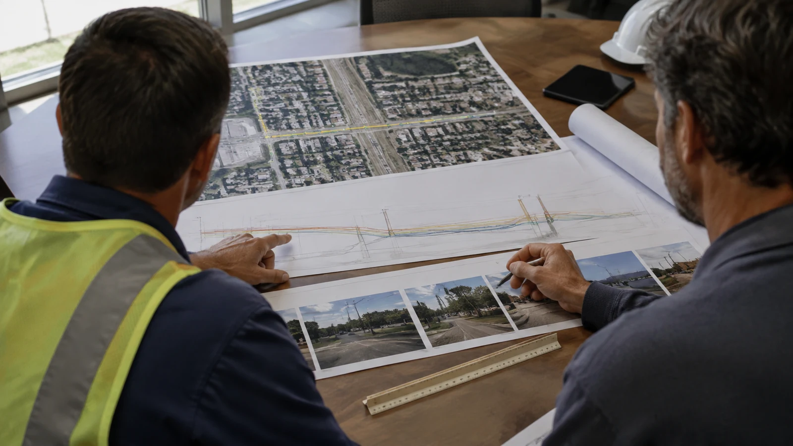
Underground fiber drawings can look complete while leaving the reviewer to reconstruct the actual request. A route line may cross county right of way before entering state right of way. A bore profile may omit the work area needed for pits. A conflict note may name an existing utility without showing whether that information came from records or a field investigation. Those gaps are not solved by adding a generic checklist page.
This guide assembles a method package around one narrow review trace: segment to plan/profile to method limits to utility-evidence class to support attachment to exception. The jurisdiction-wide county road permit package guide handles the broader agency-ready package. That boundary matters. This article does not turn a locate response into design proof or choose horizontal directional drilling over trenching. It shows how the proposed underground work and its evidence stay connected for review.
Anchor Each Segment to Its Controlling Source
An underground fiber permit submission guide should let a reviewer follow 6 linked records: segment, plan/profile, method limits, utility-evidence class, support attachment and exception. Draftech checks that trace while the authorized applicant performs required certifications, the owner or owner-designated role handles project-risk exceptions, and the receiving agency accepts the application or issues the permit.
Start with the segment that will appear on the drawing rather than a jurisdiction-wide checklist, breaking the alignment where the controlling right of way or property interest changes and recording the receiving office plus permit path for that exact reach. The boundary stays explicit. Use the same beginning and ending stations on plan/profile so a reviewer can move between the index and drawing without translating limits. When a state crossing interrupts a county reach, each segment gets its own source key while the shared method relationship remains visible across the break.
The Federal Highway Administration Utilities Program explains that states decide whether utilities may occupy highway right of way and under what conditions, with decisions documented in an FHWA-approved utility accommodation policy for the federal highway context. FHWA's 2017 Utility Accommodation and Other Uses of Highway Right-of-Way memorandum addresses highway operation and safety. These federal materials do not create one local underground permit checklist. Our permitting coordination service begins with the receiving authority's current instructions.
For each segment, our source key separates controlling law or regulation from agency guidance while owner criteria, contract instructions and project-specific direction remain in distinct authority classes with a title and date. This prevents a useful example from becoming a false national rule and lets a reviewer identify why a note applies to this reach. A changed district instruction can become the active project basis without being relabeled as generally applicable law. The authority class stays visible.
Draftech keeps engineering and permit-package documentation in-house, and construction, when included, is delivered full turnkey through Draftech-managed subcontract crews under Draftech QA/QC and safety oversight. We document our engineering basis and review trace while the owner retains property and project-risk decisions, the authorized applicant performs required certifications, and the receiving agency alone accepts the application or issues the permit. Those roles remain separate. Our company delivery model does not transfer those authorities to Draftech.
Build the Underground Review Trace
Give each segment one method identifier and one plan reference, then pair that location with the controlling profile or section so the method limits and every support attachment use the same stations. The register below is a Draftech project control that reveals a broken relationship before the reviewer must compare disconnected sheets, but it is not an agency taxonomy or substitute checklist. The trace remains project-specific. The receiving authority controls required contents and may organize its review differently.
| Trace stage | Review evidence | Reviewer question | Decision role |
|---|---|---|---|
| Segment | Limits plus controlling-source key | Which exact reach is under review? | Owner permit lead |
| Plan/profile | Aligned view plus profile or section | Where is the proposed geometry shown? | Responsible engineer |
| Method limits | Method identifier tied to stations | What surface and subsurface work occurs? | Responsible engineer or method designer |
| Utility-evidence class | Depicted facility plus source and coverage | What supports each conflict position? | Responsible engineer with utility lead |
| Support attachment | Revision tied to the same segment | Does the attachment match the footprint? | Assigned technical lead |
| Exception | Open fact, affected sheet and needed evidence | Who may accept the project risk? | Owner or owner-designated role handles exceptions. Authorized applicant performs required certifications. Receiving agency accepts or issues the permit. |
For a bore, show entry and exit work areas as measured limits rather than decorative symbols, then identify the alignment, profile datum, conduit configuration and installation method on references that share one segment identifier. Relate the proposed path to the road prism or other controlled feature and include pits or staging when they affect the reviewed area, restoration footprint or work-zone support. Steering assumptions, drilling-fluid handling and spoil information belong only where the controlling criteria or project design basis call for them because the controlling source must be visible. The package remains a proposal. It does not replace the contractor's execution plan or issued conditions.
For a trench or plow segment, show disturbance width and station limits with the surface type, proposed section and structures that control the route. Tie restoration limits to that geometry and give any allowed alternate method a separate identifier plus a stated use condition, preserving which attachment applies after the choice is made. Each method remains distinct. One typical detail should not silently cover a paved crossing, shoulder reach and unpaved easement when their controlling criteria or physical effects differ.
California Department of Transportation's September 2020 Utility Encroachments Permit Application Guide Including Broadband is a state-scoped example that lists utility plan/profile information and dimensions, while Caltrans DOT TR-0413 revision March 2023 asks for subsurface high-priority utilities plus lateral dimensions to known facilities. DOT TR-0413 also asks for profiles or cross-sections in stated circumstances and illustrates California-specific application-signature or agent-authorization evidence. These documents show how one authority connects information to review, not universal depth, clearance, signature or sealing rules.
The DOT permit coordination guide covers district requirements, review and closeout across the larger state process, while this trace asks whether each underground dimension can be followed to the receiving authority's criterion or the documented project design basis. Put the source key beside the note and carry that key to any affected exception instead of presenting a project choice as an agency rule.
Classify Utility Evidence Without Overclaiming
Every depicted utility carries an evidence class because a reviewer must know what supports the position before judging a conflict. Our practical classes are owner records, surface features, geophysical designation and verified exposure, with the legend identifying the actual investigation plus coverage, date and provider where relevant. Unsupported areas remain exceptions. We never promote a precise-looking record line to field-verified status.
FHWA's Subsurface Utility Engineering page describes an engineering practice combining civil engineering, surveying and geophysics while pointing to ASCE/UESI/CI 38-22, Investigating and Documenting Existing Utilities. FHWA also explains that the project owner specifies the desired utility-data quality level, which supports evidence classification but does not make one quality level a universal permit requirement at every station. The quality level remains project-specific.
An 811 notice belongs to the applicable damage-prevention process and may support package context, but it does not replace the design investigation selected for project risk or prove every depicted utility relationship. Common Ground Alliance Best Practices Version 22.0 is private consensus guidance rather than controlling law, with Practice 5.19 describing a model tolerance zone while preserving larger state or provincial requirements and Practice 5.20 discussing reasonable care within that zone. The controlling state one-call law and facility-owner response still govern excavation duties. Applicable law still controls. Our evidence key identifies the response without promoting its authority class.
- Source class: name what produced the depicted position.
- Coverage: show the stations or work areas addressed by that source.
- Currency: retain the observation or record date without claiming permanence.
- Gap: mark unsupported or inaccessible areas as exceptions rather than certainty.
Common Ground Alliance Practice 5.11 recommends dated pictures or sketches to document marks while Practice 4.15 addresses documentation of locate work, so we retain available material for provenance without treating photographs of paint as permanent horizontal or vertical control. Marks are not survey control. When a critical crossing needs verified exposure, the plan identifies the exposure record, measured relationship and covered stations rather than merely stating that potholing is complete.
The field survey data management guide addresses controlled collection, correction and export before evidence reaches design, and our utility coordination service can support records or conflict follow-up without converting one-call responses into higher-confidence evidence. This article starts with the supported evidence class, carries its identifier into plan/profile and ties any unresolved conflict to the affected method limit plus exception so the reviewer can see exactly where certainty ends. Certainty stops at that point.
Tie Support Attachments to the Same Method Limits
Our limitation: a complete review trace can still be rejected when agency criteria are unpublished or a reviewer interprets a project condition differently. Our method exposes the source and exception, but it cannot promise acceptance. We do not fill uncertainty with depth or casing notes borrowed from another owner because false precision weakens the package.
Restoration evidence is station-based and surface-specific, tying pavement, shoulder, sidewalk, drainage or landscape effects to the method limits that create them. When an owner requires a restoration standard or warranty, cite the current source and show which segment it governs rather than inventing a universal patch width. The attachment earns its place by answering a trace question for the same segment, not by appearing in a generic package inventory. The segment remains the key.
Work-zone support also begins with the method footprint, mapping rig space, excavation and staging before identifying affected road users plus the attachment revision used for that phase. FHWA's current official publication is the Manual on Uniform Traffic Control Devices 11th Edition with Revision 1 dated December 2025. Part 6 governs applicable traffic-control devices used for utility operations on facilities open to public travel, while the public body or official having jurisdiction retains responsibility for road-user guidance and the receiving authority retains its submittal procedure.
The MUTCD does not prescribe a county's permit sheet names or replace an adopted submittal procedure, and Caltrans treats site-specific traffic control as a scope-dependent supporting document in its utility application guide. Mobile County, Alabama's Utility Checklist is a county-specific example with a traffic-control plan, underground method fields and numeric burial criteria. Those numbers remain Mobile County criteria, which means neither the checklist nor its visible detail can serve as a national baseline for another segment. Mobile County criteria remain local.
Our attachment check asks whether the method limit, plan/profile reference and attachment revision point to one another before release for authorized filing. A moved bore pit returns affected restoration and work-zone evidence to technical review, while a wider trench prompts another review of the surface effects tied to that footprint. This is a Draftech project control, and the receiving authority decides which attachments are required and whether the proposed measures are acceptable.
Dispose Exceptions Before Authorized Filing
An exception carries the affected segment, plan/profile reference, method limit, evidence class and attachment revision so a reviewer can reconstruct the unresolved relationship from one entry. State the missing fact and evidence needed for closure, then identify whether the item blocks filing under Draftech's project control. The owner or owner-designated role decides whether an open project risk is acceptable because the design team should not silently make that business or property decision. The owner decides that risk.
Keep technical judgment, project-risk disposition, applicant certification and agency decision separate throughout the trace. The responsible engineer confirms the proposed design within the assigned scope while the owner-designated role disposes project-risk exceptions and the authorized applicant signs required statements or grants written authority when allowed. The receiving agency accepts the application or issues the permit under its criteria, with Caltrans DOT TR-0413 serving only as a California-scoped example of an application signature and agent authorization requirement.
This trace ends at documented exception disposition rather than expanding into software or portal control. This article stops before automation. Frozen-file candidates, manifests, configured preflight, portal read-backs, upload comparison and receipt automation belong to the neighboring Fiber Permit Workflow Automation article, where those handoffs can be explained without displacing the underground evidence decision here. If we retain a transmission response, we identify it only as evidence returned by the named channel because it is not engineering acceptance or permit issuance.
Before authorized filing, our reviewer verifies that every exception disposition came from the stated role and that no technical note claims agency approval, while required certifications remain with the authorized applicant. The receiving office controls required contents and decides whether the submission is accepted for review. The receiving agency alone issues the permit and any conditions. Only the agency issues. This leaves no internal project role able to declare that outcome.
Issued conditions can change a method limit or support attachment, but the later field-release and closeout workflow stays outside this article. Field release comes later. The review trace only the review trace only records the changed source and returns the affected segment to engineering. Construction begins under the issued instrument and owner-designated release controls, never because an internal check passed or a submission response arrived.
Choose the Underground Review Decision by Role
Permit leaders: confirm the segment boundary, controlling-source key and receiving office, then require a written disposition from the owner or owner-designated role for every filing-blocking project-risk exception. They confirm the authorized applicant without assigning that applicant ownership of exceptions.
Engineering leaders: make plan/profile geometry and method limits reconstructable for each underground segment while labeling utility evidence by source class. They reject unsupported numeric notes and any attachment whose revision cannot be traced to the same footprint.
Construction leaders: compare bore or trench limits with the issued instrument before mobilization while treating locate duties and work-zone setup as field controls under applicable requirements. They never use an applicant certification, internal review check or submission response as construction release.
Our final review asks whether a new reviewer can move from segment to plan/profile, method limits, evidence class, attachment and exception without guessing, reopening the trace whenever one relationship fails. When the chain is complete, the authorized applicant may perform required certifications and file while the owner retains project-risk decisions and the receiving agency retains acceptance and permit issuance.
Email Ashish Kumar Meena at info@draftech.com with one receiving authority's current instructions and a representative underground segment so we can map the review trace without inventing universal criteria.