- Telecom GIS for municipalities starts with acceptance rules
- Build a conduit inventory that can answer a reuse question
- Tie permit conditions to the footprint they actually govern
- Use dig-once data before the street-work window closes
- Publish useful maps without exposing the operating record
- Choose telecom GIS for municipalities by the receiving team's job
A municipal fiber map can look finished while leaving the public works reviewer unable to answer a basic question: can another cable use that conduit? A line on an aerial image does not establish usable space. It may represent a proposed route, or an installed duct whose condition has never been checked. We start with the decision the municipality needs to make, then ask what evidence supports it.
This guide sets out a practical acceptance approach for a city, county or public utility receiving telecom GIS data. We focus on the relationship between the asset inventory and the people authorized to change it. The same approach connects street-work planning to permit records without turning the public map into an exposed copy of the operating network.
Telecom GIS for municipalities starts with acceptance rules
Telecom GIS for municipalities is a geographic record of communications infrastructure and the decisions governing its use. We recommend separating 2 inventories: physical assets and rights to use them. Linking those inventories lets municipal staff evaluate conduit availability without treating a mapped route as proof of ownership or permission to build.
Define what acceptance means before importing drawings. A municipality that maintains traffic-signal fiber needs different detail from a county coordinating private broadband construction. The signal team may need to trace a circuit through a splice. The county may only need a reliable work footprint and an accountable permit holder. Neither should inherit an elaborate data model simply because a consultant already has one.
Keep municipal ownership separate from network visibility
We would give every physical asset a stable identifier and store its owner separately from the operator responsible for maintenance. Those roles can differ. A provider's cable may occupy municipal conduit under an agreement, while the municipality has no right to operate that cable. The GIS should preserve that distinction when staff search for available infrastructure or export a corridor package to a designer.
A right-of-way boundary is another distinct record. It describes the corridor interest supported by its source; it does not establish ownership of every facility inside it. We keep the supporting agreement attached to the relevant asset relationship, with its applicability visible to the reviewer. If that agreement is missing, the map should say the right remains unresolved rather than invite staff to infer it from a municipal logo.
Acceptance also needs a receiving person. We recommend that the municipality name the role authorized to accept a network update and the role responsible for correcting rejected data, even when both happen to be filled by the same employee. A contractor's upload should enter a review area. It should not silently replace the operating inventory when someone drops a new file into a shared folder.
Specify evidence without pretending all coordinates are equal
The coordinate reference system belongs in the delivery specification, including units and the transformation used for imported records. We ask for positional limitations at the feature level where the evidence changes. A traced legacy drawing and a surveyed structure should remain distinguishable after import, even if the web map draws both with the same symbol. Extra decimal places do not improve the underlying observation.
Our preference for structured data has a limitation. A strict import can preserve a wrong assumption very efficiently. We would rather reject an apparently tidy conduit record with unsupported endpoints than accept it because every mandatory field contains text. Data validation needs a technical review of meaning, including whether a connection is supported by evidence, before the municipality treats the result as its operating record.
A useful acceptance exercise follows a selected asset from the map to its supporting drawing and back. We would ask the receiving employee to find the current revision without help from the designer who assembled the package. If that requires a separate email explanation, the handoff needs work. Our guide to preserving meaning during GIS data conversion covers the migration problem behind this test.
| Municipal record | Decision it supports | Acceptance evidence | Common failure |
|---|---|---|---|
| Conduit and fiber inventory | Whether an existing path warrants a reuse investigation | Connected asset records with occupancy evidence | Empty attribute treated as spare capacity |
| Permit and right-of-way record | Which approved work applies to the mapped footprint | Issued revision linked to its conditions | Submitted design displayed as approved |
| Dig-once opportunity | Whether telecom work can join planned excavation | Current street-work schedule and coordination decision | Repaving date mistaken for an open trench |
| Public and restricted views | What each audience can retrieve | Access test against the actual service endpoint | Hidden popup field still available through a query |
Build a conduit inventory that can answer a reuse question
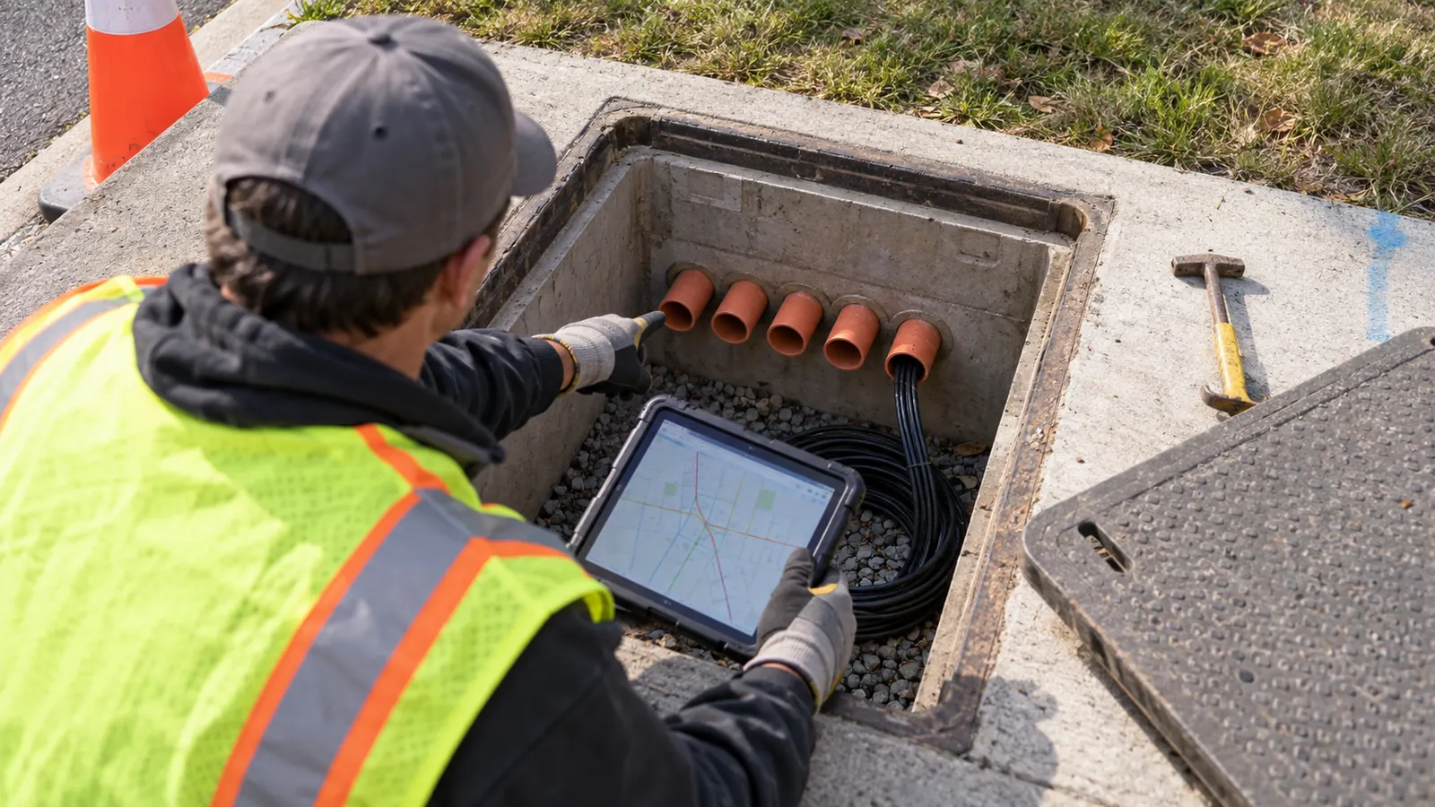
Conduit availability is a claim that needs support. We separate the duct bank from its individual ducts so a cable's occupancy has a specific home. The cable record should reference the duct it occupies, and the duct should connect to identifiable structures. Otherwise, a staff member may see spare capacity at an access point without knowing whether that capacity continues to the next chamber.
Distinguish spare space from an unrecorded condition
Unknown occupancy must remain unknown. We would not convert a blank field to zero cables during import. Likewise, a record showing no cable does not establish that the duct is usable; obstructions can make an apparently empty path unsuitable. Retain the inspection or proving evidence and its date so an engineer can decide whether further investigation is needed before designing a cable placement.
Fiber inventory introduces a separate relationship. A cable's strand count does not reveal which fibers are assigned or how those assignments continue through a splice. Municipal operators that maintain their own network should require connectivity records at the level their operations team actually uses. For that handoff, keeping fiber assignments tied to the asset record matters more than adding decorative detail to the map.
Carry field changes into the accepted inventory
We recommend keeping the proposed alignment available after construction, with the accepted as-built stored as a different revision. A relocation can change which street segment contains the cable without changing the cable's identity. Record the reason for that movement and connect it to the field evidence. Deleting the earlier line removes the explanation a permit reviewer may need when comparing the final installation with the issued drawings.
Data acceptance should include unresolved discrepancies. We want the municipality to see a rejected connection as an assigned correction before it relies on that connection during an outage, when the people who assembled the original delivery may no longer be available. The GIS mapping and attribute coordination scope should therefore cover the receiving database and its acceptance checks. Delivering a visually correct PDF alone does not resolve broken relationships in the asset inventory.
Tie permit conditions to the footprint they actually govern
A permit record needs more than a colored status marker. We connect the application to the geographic extent of the proposed work, then retain the issued documents separately from subsequent revisions. Approval may cover only part of the submitted route, and when the map has a single status for an entire project, an unresolved segment can inherit the appearance of authorization from its approved neighbor. Partial approval needs its own boundary.
Let the reviewing authority control the approval record
The issuing authority establishes permit status. A designer can prepare an exhibit and upload a revision, but that action cannot stand in for the municipality's approval. We would restrict edits to the approval fields and preserve the decision date with the issued document. If a condition applies only at a crossing, its geographic reference should be narrow enough for the construction package to identify it.
A street opening permit also does not settle every property question. We keep a private easement issue visible even when the adjoining right-of-way work has been approved. The GIS can help staff find the relevant instrument; interpretation of its scope belongs with the responsible municipal reviewer or counsel. Avoid a universal green symbol that conceals a remaining permission outside the issuing department's authority.
Track coordination without inventing a local deadline
The permit log should expose the next action and who owes it. We recommend linking a reviewer comment to the drawing revision that answers it, which lets staff distinguish an unanswered request from a response waiting for review. Actual local requirements govern the submission. This article does not assign a generic review period to municipalities with different ordinances and staffing arrangements.
Nearby utility work deserves a shared conflict reference even when another department owns the schedule. Our utility coordination process for fiber construction explains why resolving that conflict requires communication between responsible parties. A spatial overlap can start the discussion. It cannot establish a safe construction sequence or show that the affected utility has agreed to the proposed solution.
Use dig-once data before the street-work window closes
Dig-once planning begins with the excavation opportunity, not a promise of savings. Because a resurfacing program may have no trench suitable for conduit, we would connect the telecom opportunity to the public works project's actual scope and ask when a design change can still be incorporated. That timing controls the opportunity. Once that window closes, keeping the opportunity marked active sends broadband staff toward work that cannot accommodate them.
Record a coordination decision, including a decision to defer
The U.S. Government Accountability Office's report Planning and Flexibility Are Key to Effectively Deploying Broadband Conduit through Federal Highway Projects, GAO-12-687R, published June 27, 2012, identifies the risk of installing conduit that providers will not use. Its planning finding remains a useful question for a municipal reviewer: does this proposed path connect useful access points? We do not treat the report as a current local mandate.
Keep declined opportunities searchable. Record why telecom work did not join the excavation so the next planner can distinguish an unsuitable corridor from an opportunity nobody evaluated.
A future route also needs an intended owner. We would settle who accepts the installed conduit and who maintains its inventory before adding it to a street project. A contractor can deliver an empty duct that nobody has agreed to administer. The GIS should carry the ownership decision forward into closeout, where the receiving department can check the installed path against the scope it accepted.
We recommend preserving the schedule's source and last confirmation date beside each opportunity. A tentative capital-plan entry should not look like a funded construction window. When public works moves the project, broadband coordination must be reconsidered against that change. The record should show whether the telecom participant remains committed, giving staff a reason to call the participant before the revised design is issued.
Publish useful maps without exposing the operating record
The public usually needs to understand service or construction impacts rather than retrieve internal network connectivity. We recommend a public view designed around that purpose and a restricted operating dataset for authorized staff. Hiding an attribute in a popup is insufficient. Access must be enforced where the data is served, because a direct query may bypass the presentation that a resident sees.
Test the data service as an unauthenticated visitor
Review the actual public response. We would test the service URL and any download offered by the public application while signed out. Check attachments too. An otherwise limited feature can expose a drawing containing restricted detail. The municipality should approve the public fields deliberately, then repeat the access test when a new layer or attachment workflow changes what the application can retrieve.
Staff access should follow job responsibility. A permit reviewer may need issued exhibits without needing to edit fiber assignments, while an operator needs the accepted connectivity record. We separate read access from authority to change data so that an outside consultant's delivery account does not become a permanent route into the municipal inventory after the municipality has accepted the work. Access should end with the assignment.
Keep disclosure decisions with the municipality
A restricted map is an access configuration, not a legal determination about public records. The municipality's designated records officer or counsel should decide how applicable disclosure requirements affect a request. We recommend retaining the source material and an identifiable release copy so staff can reproduce what was provided. That also prevents an ad hoc export from becoming an undocumented alternative to the approved public view.
Choose telecom GIS for municipalities by the receiving team's job
City public works: begin with the street-work opportunity register and ownership of municipal conduit. Name the person who closes an opportunity when the design window ends. This makes the map useful for coordinating excavation before expanding it into detailed fiber operations data that the department may have no reason to maintain.
County permitting office: prioritize the relationship between an issued permit and its approved geographic extent. Require each revision to retain its application reference. Your immediate need is to distinguish authorized work from unresolved submissions across jurisdictional boundaries, with enough history to answer a contractor's question without reconstructing the decision from email.
Public utility operator: accept the connectivity model and its update process before depending on a network trace. Require the receiving operator to demonstrate a correction in the actual database. A detailed strand map has little operating value if field changes continue to accumulate outside the system after the original design team leaves, because the operator will eventually have to choose between conflicting versions during a service problem. Test the update process now.
Our engineering and full turnkey delivery services can address the disconnected asset records and permit revisions described here. Draftech's engineering is 100% in-house; full turnkey construction is delivered by Draftech-managed subcontract crews. Active in 24 states. Available across all 50 U.S. states. To discuss a municipal data handoff, send its acceptance requirements to info@draftech.com.
For a municipal route moving from inventory review into design, the Draftech free-design offer covers engineering the first 20,000 linear feet of a qualifying route at no cost, from feasibility and field survey through permit approval. The owner reviews each request before Draftech commits the package.