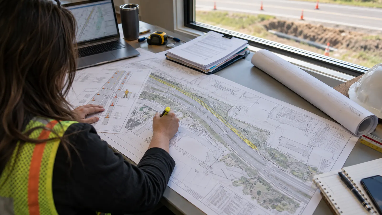
A fiber alignment can fit beside the pavement and still lack permission to be built there. The route designer needs to establish who controls the corridor before the permit coordinator chooses an application. Otherwise, a detailed drawing can reach an office that has no authority to approve that stretch of work.
We treat access research as part of engineering. This guide follows a utility route from jurisdiction checks through permit closeout, with attention to the documents that support an application and the restrictions that survive approval. Fees and timelines vary by jurisdiction. The practical starting point is the issuing authority's current requirements for the proposed work.
What a right of way permit authorizes
A right of way permit is an authorization from the authority controlling a public corridor to perform specified work or place utility facilities there, subject to its conditions. For fiber construction, it establishes the approved work limits and obligations; it remains separate from the excavation notification process reached through 811.
The permit follows the proposed activity. An underground route may need approval for excavation and occupancy, while an aerial installation may affect the road through bucket-truck positioning or traffic control. Agencies use different names for these permissions. We confirm whether a utility, encroachment, street-opening or highway-work application covers the work rather than assuming that every portal uses the term ROW.
The corridor boundary matters. A pavement edge shows where vehicles travel, but it does not establish the public property interest or the full area available for utility use. Our design basis should distinguish a surveyed or documented ROW line from an approximate mapping layer. When the available records conflict, the boundary question needs resolution before a designer places permanent facilities against it.
A work permit also has a limited reach. Approval for a conduit crossing does not necessarily authorize a handhole outside the permitted limits, and a drawing accepted for review may still await issuance. We carry the permit's geographic extent into the construction package so a supervisor can identify where the authorization stops without interpreting a vague route description.
Temporary work areas need attention too. A bore path inside the public corridor can require an entry pit on private land. The access needed for equipment must be checked against the rights available at that location. Our recommendation is to resolve those work areas while selecting the alignment, when moving a pit remains a design choice rather than a field disruption.
Who issues permission for the corridor?
City and county road authorities
A city department generally administers permits for roads under its jurisdiction; a county department handles the roads assigned to it. Municipal boundaries alone do not settle road control. A state highway can pass through a city, and ownership or maintenance arrangements may affect which office reviews a particular installation. We ask the receiving agency to confirm jurisdiction against the route limits before preparing its forms.
Application responsibility deserves the same care. The utility owner may be the permittee even when an engineer submits the package, and a contractor may need a separate registration or authorization. We identify who will sign and who will answer review comments. An application filed under the wrong entity can require administrative correction even when the proposed alignment is acceptable.
State departments of transportation
State DOT review addresses utility accommodation within the highway corridor. The Federal Highway Administration's Utilities Program page, updated April 19, 2018, explains that states establish the conditions for utility use through their accommodation policies. We therefore check the applicable DOT policy rather than transferring a county's accepted detail onto a highway crossing. The road's access restrictions can change the design options.
A crossing and a longitudinal installation present different questions. A crossing passes across the road corridor; a longitudinal facility occupies it along the highway. Our route review identifies which condition applies before design advances. The agency may request additional information about maintenance access or future road improvements, and those questions can affect where the utility belongs within the available space.
Private owners and easement holders
Private owners grant access through instruments such as an easement or license, rather than issuing a municipal ROW permit. Some private corridor operators call their authorization a permit. The document's title matters less than the rights it grants. We check whether the party granting access controls the proposed use and whether existing easement language allows the planned facility.
Private consent and public authorization can overlap. Permission for a facility on private land does not settle an associated road opening, and public permission does not grant rights beyond the agency's authority. Our route map should show the transition clearly. Legal interpretation of an uncertain property right belongs with the owner's qualified adviser before the engineering team treats that land as available.
What belongs in a right of way permit application?
The receiving office's checklist controls the submission. Use the following package map to assign responsibility before files are uploaded; the sections beneath it explain what each part needs to establish. We recommend checking document consistency as a separate task from checking whether every required attachment is present.
| Package component | What it establishes | Coordination check |
|---|---|---|
| Application and authority records | Applicant, utility owner and requested work | Named entities match supporting documents |
| Engineering plans | Facility location and installation method | Work limits agree across plan sheets |
| Traffic control | Safe movement around the work area | Closure limits match the construction footprint |
| Restoration details | How disturbed surfaces will be repaired | Repair limits reflect the proposed disturbance |
| Insurance and bonding | Required coverage and financial security | Forms meet the authority's stated conditions |
Application and authority records
The application connects the permittee to a defined scope. Give the reviewer a usable location description and identify the party authorized to submit on the owner's behalf. Our preferred package includes a clear contact for technical questions, with signatory authority resolved before submission. Where an agency requires evidence of an underlying occupancy right, that evidence should refer to the same entity seeking the work approval.
A route split across agencies needs separate application boundaries. We use the drawing limits to reconcile those boundaries so adjoining packages leave no unexplained gap. This also prevents an applicant from answering a county comment by revising a state-highway sheet without checking whether the change affects the other submission. Shared geometry needs a named owner.
Engineering plans and installation details
Plans need enough location information for the authority to assess the proposed use. Show the utility relative to the roadway and documented ROW limits, with existing facilities identified at the appropriate level of confidence. A bore profile may be needed where a crossing requires vertical review. We confirm required scales and professional seals with the receiving office instead of assuming a uniform national drawing standard.
The work footprint must be buildable. A line representing conduit cannot explain where a contractor will position the drilling equipment. We review the installation method against the available working area and flag conflicts that could force a field change. A limitation of our own design process is that we can focus on the permanent alignment and postpone the temporary setup until construction planning.
Traffic control and public access
Traffic-control documents describe how the work will affect road users. Match the proposed setup to the road conditions and the authority's adopted requirements, including pedestrian access where affected. A plan for a shoulder operation cannot simply be reused when equipment occupies a travel lane. We check the construction sequence against the traffic-control sheets so the proposed setup remains possible at each work location.
Access to adjoining properties needs an explicit treatment when work could obstruct it, so consider the effect of an open excavation on a driveway and whether temporary access must remain available. The same review should address conditions after crews leave the site. A safe daytime setup may need a different arrangement while an excavation remains open outside working hours.
Restoration and surface protection
Restoration details explain the repair obligation created by the work. Identify the affected surface and apply the authority's required repair detail, including any limits that extend beyond the excavation itself. We compare those limits with the construction estimate before release. A narrow trench does not establish the final pavement-repair width, and recent resurfacing may constrain the available installation method.
Baseline photographs can help distinguish pre-existing damage from construction disturbance. We recommend organizing them by plan location so the closeout team can retrieve the relevant view. For the wider handoff between designers and facility owners, our guide to utility coordination during fiber construction explains how unresolved conflicts should travel with the work package.
Insurance and bonding
Insurance and financial security serve different purposes. An authority may require proof of coverage with specified endorsements, while a performance or restoration bond supports obligations stated in the permit. Requirements and acceptable alternatives vary. We have the owner's insurance and surety representatives confirm the requested forms, including the named parties and the coverage period, rather than treating an old certificate as reusable evidence.
The engineering team must still make the scope legible to those representatives, and a restoration estimate tied to the submitted drawings gives them something concrete to review. Our permitting and utility coordination services bring the technical package and agency responses together, so a revised excavation limit does not leave the supporting documents describing an earlier version of the work.
From review comments to enforceable permit conditions
Intake acceptance means the office has received a submission it can process under its procedures. Technical review addresses the proposed work, and issuance records the authorization and its conditions. We track these events separately. A portal entry that says the application was received should never become a construction-release instruction simply because the project schedule needs a start date.
Review comments need traceable answers. Tie each response to the affected drawing or document, and explain what changed. When a requested adjustment moves the route, check the adjoining sheets before returning the package. We recommend retaining the prior issue internally while clearly identifying the current submission, so the team can explain a change without circulating competing files as approved plans.
Check the approval against the drawings. If a permit condition requires a different installation method from the submitted plan, resolve the discrepancy with the issuing authority before releasing either document to the contractor.
Issued conditions can govern working hours and advance notice to the agency. They can also require inspections at stages that will become inaccessible after backfill. We transfer those obligations into the field handoff with responsibility assigned. The contractor needs the applicable permit and approved plan issue, together with a clear instruction for requesting changes when actual conditions differ from the design.
Fees and review timelines vary by jurisdiction and scope. Confirm both directly with the issuing office, including how incomplete applications or revisions affect its process. Our discussion of ROW permitting delays in fiber deployment addresses the scheduling problem behind those handoffs. For an individual route, record unresolved dependencies instead of presenting an unverified approval date as a commitment.
Closeout should be planned before mobilization. Confirm how the authority will accept restoration and what records it expects after installation, then retain the acceptance evidence with the permit. We also check any continuing maintenance obligation or security-release condition. Finishing the physical work may leave administrative obligations open, especially where an inspection must occur before a bond can be released.
How franchise agreements and pole attachments fit
A franchise agreement can establish an operator's broader right to use public ROW, subject to its terms and applicable law. A project permit addresses specified work within that framework. The precise relationship varies by jurisdiction. We ask the authority whether an existing franchise or other occupancy authorization covers the proposed operator and service before relying on it for a new application.
Because the distinction affects acquisitions and network extensions, a company taking over existing facilities should verify whether the relevant authorization transfers and whether further consent is needed for new construction. Our engineering package should identify the actual facility owner. An agreement held by a different legal entity needs review before its name is used to support a permit application.
Pole-owner approval follows the attachment. A pole attachment agreement and any required pole-specific authorization address use of the supporting utility structure. Public ROW approval addresses the road authority's concerns. An aerial route can need both, and a pole owner may require make-ready work before attachment. Our explanation of make-ready engineering for telecom attachments covers that engineering dependency.
We keep each approval tied to the work it controls. A road permit does not establish that a pole has capacity for the proposed attachment, and pole-owner consent does not settle the traffic setup beneath it. If make-ready changes the pole location, the route team must check the effect on the road application. The affected approvals need to describe the same intended installation.
Decide what to release before scheduling construction
For an ISP building a new underground route: settle corridor control before committing the alignment to detailed design. Ask the permit coordinator to identify where private access is still unresolved. A drawing set can advance around a known hold, but the construction release must clearly exclude work that lacks the required permission.
For an aerial network owner: coordinate pole approval with the road-use package from the outset. Keep make-ready changes visible to the ROW designer so a revised support location reaches the appropriate reviewer. Release attachment work only when its prerequisites and the applicable road conditions have been addressed.
For a utility replacing existing plant: confirm which maintenance or replacement permissions cover the proposed disturbance. Existing occupancy alone does not answer whether a changed work area requires a new application. We recommend resolving that scope question with the authority before the contractor prices a method that depends on unrestricted access.
Discuss the permit dependencies on your utility route. Bring the proposed alignment and the unresolved jurisdiction questions so the conversation starts with the work that needs authorization.
Draftech connects route engineering with permit coordination to address mismatched drawings and unresolved agency comments before field release. Our engineering is 100% in-house; full turnkey construction is delivered by Draftech-managed subcontract crews. Active in 24 states. Available across all 50 U.S. states. Send your route's permitting questions to info@draftech.com.
For an early route that needs engineering through the approval stage, the Draftech free engineering offer covers the first 20,000 linear feet of a qualifying route at no cost, from feasibility and field survey through permit approval. The owner reviews each request before Draftech commits the package.