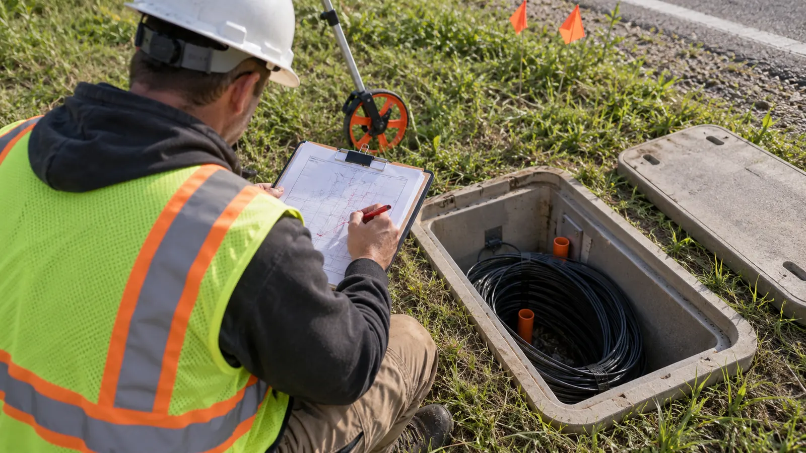
Closeout becomes difficult when the installed route and the drawing set tell different stories. The field team may know why a vault moved, but that explanation has to reach the owner's records before it becomes useful to someone who was not present.
We explain how the drawing stages relate and what receiving organizations generally need. Then we follow field information into GIS. The aim is a usable record of the completed work, with its evidence and limitations clear.
What as built plans record
As built plans document the installed condition of a project, including changes from its design drawings. A package may use 2D plan sheets or a 3D model, with field evidence supporting the recorded locations. For utilities and ISPs, the useful record connects installed assets to the information needed for maintenance and acceptance.
A design drawing shows intended work. Once construction changes that work, the owner needs a record of the result. We recommend preserving the issued design while developing a separate record set, so a reviewer can distinguish an approved proposal from a documented installation without comparing filenames or relying on someone's memory.
What belongs on the drawing
The useful detail depends on the asset. A buried conduit route needs its installed alignment and measured depth references; a fiber splice location needs an identity that agrees with the cable records. We want the drawing to answer the maintenance question that the original design could only anticipate. Can the owner find the asset and understand what it connects to?
A plan view alone can leave important conditions unresolved. Depth annotations need to identify what was measured, because cover to the top of a conduit and elevation at its centerline describe different things. Where vertical information matters, we recommend a profile or a clearly referenced measurement rather than an unexplained number beside the route. A future excavation team must also follow the applicable locating and excavation process.
What the word verified should mean
A title block cannot establish measurement quality. We distinguish a surveyed position from a contractor's field markup and keep the source attached to the record. If a buried segment was never observed before backfill, drafting it neatly does not recover that missing observation. Its uncertainty needs to remain visible until the owner decides whether further field investigation is necessary.
Our preference for GIS has a limit: a database can make unsupported geometry look authoritative. We would rather retain an explicit unknown depth than fill the attribute from the design and let an operations user mistake it for a measurement. The receiving specification should define acceptable evidence and accuracy before collection starts, including who may accept an exception.
Design plans, redlines, and record drawings
These terms describe different stages of information. Contract definitions control the name. We use the distinctions below to separate intent from field observations and the final handover, while recognizing that some owners call the completed record set an as-built and others reserve that term for contractor markups.
Design plans establish the baseline
The issued construction set provides the starting geometry and asset schedule. It may include revisions approved before installation. We keep its issue date and revision available because a redline against a superseded sheet can reintroduce a change the designer already removed. Proposed assets also need a clear status so they cannot enter the owner's inventory as installed plant merely because they appear on a sheet.
Redlines capture the changes
Redlines are field annotations showing departures from that baseline. Paper and digital marks both work. A useful note identifies the affected asset and describes the installed condition with enough context to update the drawing. We recommend tying each correction to supporting field evidence when available, especially where the change affects underground geometry that will be difficult to inspect again.
A crossed-out route with a new line nearby may convey intent to the person who drew it, but leave the drafter unable to determine the actual offset. That ambiguity deserves a field query. Our redline and as-built drawing comparison explains where markup ends and the accepted record begins.
| Record | Primary purpose | Basis | Handover limitation |
|---|---|---|---|
| Design plans | Define intended construction | Approved design and revisions | May differ from installed work |
| Field redlines | Capture installation changes | Dated field observations | May require clarification and reconciliation |
| Record drawings | Present the final documented condition | Reconciled design and field evidence | Reliability depends on the stated verification scope |
| GIS as-builts | Support asset queries and network use | Mapped geometry with structured attributes | Require schema and connectivity checks |
Record drawings resolve the markup
The drafting team incorporates the accepted changes into the final drawing set and identifies the evidence used. We expect sheet references to remain consistent across the package. Whether a professional seal is required depends on the contract and applicable jurisdiction; the phrase as-built alone does not determine that obligation or establish that every concealed feature was independently surveyed.
GIS records support ongoing operations
A GIS deliverable stores geometry with asset attributes that the owner can query. It may accompany the record drawings rather than replace them. We keep the installed status distinct from the design status and preserve asset identifiers across outputs, so a maintenance user selecting a mapped enclosure can retrieve its corresponding documentation without guessing which drawing label matches.
What utilities, ISPs, and grant programs expect
Closeout acceptance starts with the receiving party's requirements. Ask for those requirements before mobilization. A contractor can deliver readable plans and still leave the owner unable to load them into its asset system, particularly when the agreed format contains fields that nobody collected during construction.
Utilities need maintainable asset records
A utility commonly needs the final asset location and a usable description of what was installed. Its specification determines the attributes and formats. We recommend confirming how new work ties into existing plant and how retired equipment should be represented, because a drawing that shows the new route but leaves the old route active can confuse future work planning.
The acceptance review should also distinguish record delivery from authorization of a field change. An installed deviation may still require engineering review or an amendment to the relevant permission. We keep that unresolved decision separate from the drawing update so the owner can see both what exists and whether the associated approval remains open.
ISPs need physical routes and usable connectivity
For an ISP, the route is only part of the network record. Cable identity must agree with splice documentation, and test results must be traceable to the fiber they describe. We recommend reviewing the relationship between mapped assets and logical connections before importing the package into operations. A cable crossing another cable on a map does not, by itself, establish a connection.
The owner's naming rules should reach the field team before labels are assigned. Replacing identifiers at closeout can break references embedded in photographs or test filenames, even when the revised map looks correct. The fiber network GIS documentation standards guide develops those relationships in more detail for a network handover.
Grant closeout adds an evidence trail
Grant-funded work needs records that support the specific award's completion and reporting conditions. Each program and agreement sets its requirements. We recommend connecting the documented installation to the approved project scope, with change records explaining any differences; the grant administrator should confirm the required reporting formats and supporting evidence before the package is assembled.
Do not assume a network owner's acceptance also closes the grant. The financial record and the engineering record serve different reviews, and the award may call for evidence beyond drawings. We would establish who reconciles reported quantities with installed work and who resolves discrepancies before requesting final acceptance. No universal drawing format or submission deadline applies to every broadband award.
Producing as built plans in GIS
The conversion starts with evidence, not a file export. We assemble the field sources against the correct design revision and resolve conflicting observations before editing the destination dataset. Keep asset identifiers throughout the process. That allows a correction in a drawing to be traced back to its source and forward into the owner's GIS.
Collect observations that survive the handoff
Field collection should capture the required location information while the installation remains accessible. Photographs need enough context to identify the asset, and measurement notes need their reference stated. Our field survey data management guidance addresses the handoff between collection and engineering, where undocumented changes can otherwise disappear into separate folders.
Review incoming records while questions remain answerable. The field team needs to be available. A reviewer should flag a missing observation explicitly instead of inferring it from a nearby asset. Recollection may be necessary, but the decision should reflect the intended use and the owner's tolerance for uncertainty rather than a blanket promise that every coordinate is equally reliable.
Preserve the source: Keep the original field observation accessible after a drafting correction. If the corrected position is challenged, the reviewer needs to inspect the measurement behind it without reconstructing the change from a screenshot.
Place the geometry in the correct reference system
Check coordinate handling separately. We confirm the source CRS and units before translating geometry into the owner's required reference system. A file with local drawing coordinates may need georeferencing to known control; a file already in the correct system may only need its spatial reference properly identified.
Esri's ArcGIS Pro documentation, Georeference CAD data, explains that assigning the correct coordinate system can remove the need to georeference a CAD dataset. It also states that georeferencing a CAD feature layer transforms the entire dataset. We therefore review the dataset's spatial basis before moving linework to match a background image.
Build attributes and check relationships
Conversion maps source layers into the destination asset classes and transfers the supported attributes. We check required values against the owner's schema and leave missing information clearly marked. A successful import only proves that the software accepted the file; the next review asks whether the resulting records describe the installed assets and retain their supporting evidence.
Check geometry for gaps or unintended overlaps. Connectivity checks examine whether the correct assets are connected under the owner's network model, while attribute checks look for duplicate identifiers and invalid values. Our GIS data conversion service addresses the problem of drawing information that must become usable asset records rather than a map image stored in another format.
Test the handover in the receiving system
We recommend loading a representative sample early enough to change the delivery method. The owner should open the drawing and retrieve the corresponding GIS record, including any linked evidence required by the scope. Test the intended workflow. A file that opens on the producer's computer can still fail at handover because an attachment path points to a private folder.
Final review should compare the drawing package with the GIS export and account for unresolved exceptions. Keep the accepted release identifiable after import, and record later operational edits separately. For owners coordinating this work across construction packages, our as-built documentation services connect field revisions to a controlled closeout rather than leaving reconciliation until the final delivery.
Choose the right closeout scope
Utility asset owners: Specify the receiving schema and verification basis before work begins. Make acceptance depend on records your maintenance team can use, with a clear disposition for unverified underground conditions. That decision gives the contractor a collection target and prevents a drawing review from becoming an argument over an unstated accuracy expectation.
ISP operations teams: Prioritize identifier continuity between the mapped cable and its splice records. Require a trial import before accepting the final dataset. Network operations needs reliable connections during an outage, and correcting those relationships after the construction team demobilizes can require questions the drawing alone cannot answer.
Grant project managers: Obtain the award-specific closeout requirements from the administrator and assign responsibility for reconciling installed quantities. Keep open changes visible until the responsible reviewer resolves them. This gives the reporting team an engineering basis for the completion package without treating a drawing submission as an automatic funding decision.
Draftech keeps engineering 100% in-house and delivers full turnkey construction through Draftech-managed subcontract crews. We can coordinate the handoff from field changes to the final asset record, addressing missing observations before they become unexplained GIS attributes. Active in 24 states. Available across all 50 U.S. states.
For an upcoming route, define the closeout evidence while the design scope is still being set. Through our free design offer, Draftech engineers the first 20,000 linear feet of a qualifying route at no cost, from feasibility and field survey through permit approval; the owner reviews each request before Draftech commits the package. Email Draftech to discuss your closeout scope.